


The traditional dividing line between north and south will celebrate a major birthday this weekend.
The Mason Dixon Line will have its 250th anniversary this weekend, and communities living along either side of one of the most famous divides in American geography will celebrate.
Bob Batz Jr. reports from the stretch of the Mason Dixon Line between West Virginia and Pennsylvania. Batz endeavors to explain some of the history, and clarify some of the mythology, that surrounds the Mason-Dixon.
Many will be familiar with the Mason-Dixon Line symbolizing the divide between the North and the South. That definition goes back to 1820, when the U.S. Congress used it as a basis for the imperfect border between the slave states of the South and the free states to the North before the Civil War.
But that never was what this line was meant to be. It was just a property line, like the kind you check when you buy a house, albeit a really long and difficult one to survey.
According to Batz, the line actually had its genesis in the 17th century, but things got serious when British authorities called in astronomer Charles Mason and surveyor Jeremiah Dixon to settle property disputes families living between Pennsylvania and Maryland and what was then Virginia. Surveying work started in 1763, but the line was complete in 1767:
They’d planned to survey a line — 39 degrees, 43 minutes and about 17 seconds north latitude — west from the northeastern corner of Maryland all the way to the southwestern corner of Pennsylvania. But in October 1767, at Dunkard Creek near Mount Morris, their Native American guides stopped as they’d crossed a boundary — a war path — of indigenous enemies of their own. So Mason and Dixon stopped, too, having marked 233 miles, just more than 21 miles short of their goal.
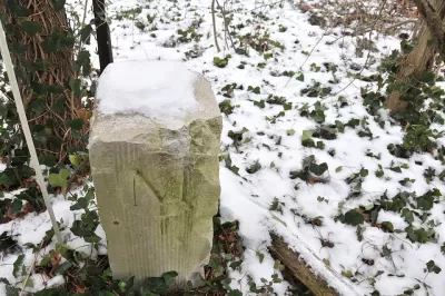
Three days of celebration will take place at Mason-Dixon Historical Park in West Virgina, where the last markers of the line were placed.
FULL STORY: The Mason-Dixon Line turns 250


Maui's Vacation Rental Debate Turns Ugly
Verbal attacks, misinformation campaigns and fistfights plague a high-stakes debate to convert thousands of vacation rentals into long-term housing.

Planetizen Federal Action Tracker
A weekly monitor of how Trump’s orders and actions are impacting planners and planning in America.

San Francisco Suspends Traffic Calming Amidst Record Deaths
Citing “a challenging fiscal landscape,” the city will cease the program on the heels of 42 traffic deaths, including 24 pedestrians.

Adaptive Reuse Will Create Housing in a Suburban Texas Strip Mall
A developer is reimagining a strip mall property as a mixed-use complex with housing and retail.

Study: Anti-Homelessness Laws Don’t Work
Research shows that punitive measures that criminalized unhoused people don’t help reduce homelessness.

In U.S., Urban Gondolas Face Uphill Battle
Cities in Latin America and Europe have embraced aerial transitways — AKA gondolas — as sustainable, convenient urban transport, especially in tricky geographies. American cities have yet to catch up.
Urban Design for Planners 1: Software Tools
This six-course series explores essential urban design concepts using open source software and equips planners with the tools they need to participate fully in the urban design process.
Planning for Universal Design
Learn the tools for implementing Universal Design in planning regulations.
Heyer Gruel & Associates PA
JM Goldson LLC
Custer County Colorado
City of Camden Redevelopment Agency
City of Astoria
Transportation Research & Education Center (TREC) at Portland State University
Jefferson Parish Government
Camden Redevelopment Agency
City of Claremont