


The variables in public transit service have never been so brightly and kinetically illustrated.

Will Geary explains the thinking behind, TransitFlow, "an experimental set of tools to generate spatial-temporal transit frequency datasets and visualizations from the command line."
That is, TransitFlow allows the creation of animated maps showing the movement of public transit modes around cities and regions. The TransitFlow team created the tool to help illustrate the importance of frequency, among other critical aspects of transit service.
See below for examples of the San Francisco Bay Area, New York City, Amtrak trips around the United States, and Mexico City.
There are a lot more examples from around the United States and the world available on Geary's Vimeo portfolio.
FULL STORY: TransitFlow — using Python and Processing to visualize regional transit frequency


A New Way to Explore Local Transit Ridership Data
TransitCenter has released a new National Ridership Map.

Mapping Climate Impact at the Neighborhood Level
A consumption-based analysis illustrates the differences in average household emissions across census tracts.
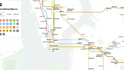
The New New York Subway Map Works in Real Time
There's a new chapter, and maybe an end, for the "Great Subway Map Debate."

Maui's Vacation Rental Debate Turns Ugly
Verbal attacks, misinformation campaigns and fistfights plague a high-stakes debate to convert thousands of vacation rentals into long-term housing.

Planetizen Federal Action Tracker
A weekly monitor of how Trump’s orders and actions are impacting planners and planning in America.

In Urban Planning, AI Prompting Could be the New Design Thinking
Creativity has long been key to great urban design. What if we see AI as our new creative partner?

King County Supportive Housing Program Offers Hope for Unhoused Residents
The county is taking a ‘Housing First’ approach that prioritizes getting people into housing, then offering wraparound supportive services.

Researchers Use AI to Get Clearer Picture of US Housing
Analysts are using artificial intelligence to supercharge their research by allowing them to comb through data faster. Though these AI tools can be error prone, they save time and housing researchers are optimistic about the future.

Making Shared Micromobility More Inclusive
Cities and shared mobility system operators can do more to include people with disabilities in planning and operations, per a new report.
Urban Design for Planners 1: Software Tools
This six-course series explores essential urban design concepts using open source software and equips planners with the tools they need to participate fully in the urban design process.
Planning for Universal Design
Learn the tools for implementing Universal Design in planning regulations.
planning NEXT
Appalachian Highlands Housing Partners
Mpact (founded as Rail~Volution)
City of Camden Redevelopment Agency
City of Astoria
City of Portland
City of Laramie