


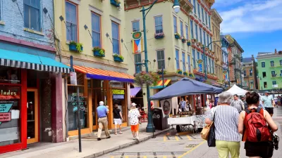
Researchers at MIT and Harvard believe that their computer vision system (i.e., artificial intelligence) helps reveal fundamental characteristics of neighborhood change.
Larry Hardesty shares news of a new "computer vision system" from MIT's Media Lab, created with partners from Harvard University, that quantifies "the physical improvement or deterioration of neighborhoods in five American cities."
In work reported today in the Proceedings of the National Academy of Sciences, the system compared 1.6 million pairs of photos taken seven years apart. The researchers used the results of those comparisons to test several hypotheses popular in the social sciences about the causes of urban revitalization. They find that density of highly educated residents, proximity to central business districts and other physically attractive neighborhoods, and the initial safety score assigned by the system all correlate strongly with improvements in physical condition.
The new tool is built on a system created four years ago, which analyzes "street-level photos taken in urban neighborhoods in order to gauge how safe the neighborhoods would appear to human observers."
Hardesty goes into a lot more detail about the ideas that contributed to the creation of the computer vision system, and the findings that have been produced in its deployment.
Linda Poon offers additional insight into the use of artificial intelligence in the analysis of urban conditions.
FULL STORY: Why do some neighborhoods improve?

Black Residents Leaving Cincinnati's Fast Growing Urban Area
The housing market in the neighborhood of Over-the-Rhine is a 'segregation machine.'
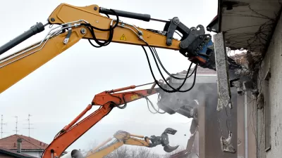
$160 Million in Bond Funding for Demolitions on the Ballot in Detroit
Proposal N, on the ballot for Detroit voters next week, will provide $160 million in bond funding for demolitions and $90 million to mothball homes for future rehab, but, according to this opinion, it won't solve the city's blight challenges.
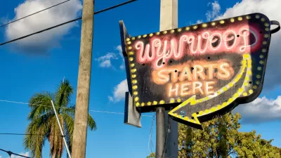
Revitalization Without Displacement: A New Model From Miami
Upzonings in working class neighborhoods usually provoke political opposition based on concerns about gentrification and displacement. But the new Wynwood Norte Neighborhood Revitalization District in Miami might have worked for a solution.

Planetizen Federal Action Tracker
A weekly monitor of how Trump’s orders and actions are impacting planners and planning in America.

Congressman Proposes Bill to Rename DC Metro “Trump Train”
The Make Autorail Great Again Act would withhold federal funding to the system until the Washington Metropolitan Area Transit Authority (WMATA), rebrands as the Washington Metropolitan Authority for Greater Access (WMAGA).

DARTSpace Platform Streamlines Dallas TOD Application Process
The Dallas transit agency hopes a shorter permitting timeline will boost transit-oriented development around rail stations.

Renters Now Outnumber Homeowners in Over 200 US Suburbs
High housing costs in city centers and the new-found flexibility offered by remote work are pushing more renters to suburban areas.

The Tiny, Adorable $7,000 Car Turning Japan Onto EVs
The single seat Mibot charges from a regular plug in about as much time as an iPad, and is about half the price of an average EV.

Supreme Court Ruling in Pipeline Case Guts Federal Environmental Law
The decision limits the scope of a federal law that mandates extensive environmental impact reviews of energy, infrastructure, and transportation projects.
Urban Design for Planners 1: Software Tools
This six-course series explores essential urban design concepts using open source software and equips planners with the tools they need to participate fully in the urban design process.
Planning for Universal Design
Learn the tools for implementing Universal Design in planning regulations.
Roanoke Valley-Alleghany Regional Commission
City of Mt Shasta
City of Camden Redevelopment Agency
City of Astoria
Transportation Research & Education Center (TREC) at Portland State University
US High Speed Rail Association
City of Camden Redevelopment Agency
Municipality of Princeton (NJ)