


The Napa River's Oxbow bypass doubles as public park space and an outlet when the river floods. The project brought together local environmentalists and the business community.

John King offers up a defense of the Oxbow bypass, a costly flood control project that doubles as a park. He writes, "it performed exactly as predicted back in 1998, when Napa County voters approved a half-cent sales tax to fund their portion of a multifaceted flood control project through the city of 80,000."
Backers of the "living river" were diverse, including the Sierra Club and the Napa Chamber of Commerce. "Environmentalists knew they wouldn't gain the necessary two-thirds support from voters without the backing of local business. Business groups understood that a safe attractive river might make the long-moribund downtown more enticing."
King acknowledges (but pushes against) critiques leveled at the project's expense. "Oxbow bypass didn't open until 2015, seven years after the project was supposed to be done. The budget soared past $500 million from an initial estimate of $220 million, due in part to the cost of purchasing 53 mobile homes and 44 structures along the river's path."
FULL STORY: ‘Living river’ rejuvenates Napa, brings needed flood control

Turning Disaster Into Opportunity
Brian Phelps reports on the power of urban landscaping to revitalize a flood-devastated city - Valencia, Spain.
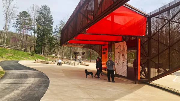
Baker Creek Pavilion: Blending Nature and Architecture in Knoxville
Knoxville’s urban wilderness planning initiative unveils the "Baker Creek Pavilion" to increase the city's access to green spaces.

‘Quiet Parks’ Highlight Importance of Silence for Public Health
The initiative recognizes parks and other areas that preserve natural quiet in a world full of noise pollution.

Planetizen Federal Action Tracker
A weekly monitor of how Trump’s orders and actions are impacting planners and planning in America.

Chicago’s Ghost Rails
Just beneath the surface of the modern city lie the remnants of its expansive early 20th-century streetcar system.

San Antonio and Austin are Fusing Into one Massive Megaregion
The region spanning the two central Texas cities is growing fast, posing challenges for local infrastructure and water supplies.

Since Zion's Shuttles Went Electric “The Smog is Gone”
Visitors to Zion National Park can enjoy the canyon via the nation’s first fully electric park shuttle system.

Trump Distributing DOT Safety Funds at 1/10 Rate of Biden
Funds for Safe Streets and other transportation safety and equity programs are being held up by administrative reviews and conflicts with the Trump administration’s priorities.

German Cities Subsidize Taxis for Women Amid Wave of Violence
Free or low-cost taxi rides can help women navigate cities more safely, but critics say the programs don't address the root causes of violence against women.
Urban Design for Planners 1: Software Tools
This six-course series explores essential urban design concepts using open source software and equips planners with the tools they need to participate fully in the urban design process.
Planning for Universal Design
Learn the tools for implementing Universal Design in planning regulations.
planning NEXT
Appalachian Highlands Housing Partners
Mpact (founded as Rail~Volution)
City of Camden Redevelopment Agency
City of Astoria
City of Portland
City of Laramie