


The Urban Archive app will be popular with anyone interested in the history of New York City. Hopefully the idea spreads to other cities soon.
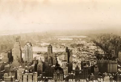
Andrew Davis shares news of a new app called Urban Archive that gelocates historic photos of New York to your mobile phone. So, imagine walking past Grand Army Plaza, with a view out to the Manhattan Bridge, and receiving a push notification from your phone that opens an image taken a century ago.
Working with Brooklyn Historical Society, the New York Public Library, and the Museum of the City of New York, Urban Archive has made accessible over 2,500 images from all five boroughs (sorry New Jersey). The newly formed nonprofit’s ambition is to create apertures into the city’s urban history in a multi-dimensional digital platform that both informs and entertains the public.
The app also includes walking tours and a side-by-side photo generator. Currently the archive includes 2,500 images from all five boroughs, but the Urban Archive is sorting and geotagging some 50,000 additional images and seeking more.
FULL STORY: New app transports you through NYC’s historic cityscape with archival photos

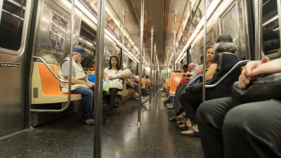
Miss the Subway? There's an App for That
The NYC Subway Sounds app is a great tool for dealing with nostalgia for the old ways of life.
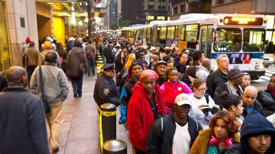
Checking in on Two of de Blasio's Big Transportation Promises
Mayor Bill de Blasio made a couple of promises about new the transportation technology that would be available to New Yorkers in 2016. The results of those promises reveal good news for drivers and some bad news for bus riders.
NYC: What Mamdani’s Rivals Can Teach Him About Transportation
The mayoral candidate won on a bold, progressive platform. Some of his opponents had even bolder ideas.

Planetizen Federal Action Tracker
A weekly monitor of how Trump’s orders and actions are impacting planners and planning in America.

Maui's Vacation Rental Debate Turns Ugly
Verbal attacks, misinformation campaigns and fistfights plague a high-stakes debate to convert thousands of vacation rentals into long-term housing.

San Francisco Suspends Traffic Calming Amidst Record Deaths
Citing “a challenging fiscal landscape,” the city will cease the program on the heels of 42 traffic deaths, including 24 pedestrians.

Amtrak Rolls Out New Orleans to Alabama “Mardi Gras” Train
The new service will operate morning and evening departures between Mobile and New Orleans.

The Subversive Car-Free Guide to Trump's Great American Road Trip
Car-free ways to access Chicagoland’s best tourist attractions.

San Antonio and Austin are Fusing Into one Massive Megaregion
The region spanning the two central Texas cities is growing fast, posing challenges for local infrastructure and water supplies.
Urban Design for Planners 1: Software Tools
This six-course series explores essential urban design concepts using open source software and equips planners with the tools they need to participate fully in the urban design process.
Planning for Universal Design
Learn the tools for implementing Universal Design in planning regulations.
Heyer Gruel & Associates PA
JM Goldson LLC
Custer County Colorado
City of Camden Redevelopment Agency
City of Astoria
Transportation Research & Education Center (TREC) at Portland State University
Jefferson Parish Government
Camden Redevelopment Agency
City of Claremont