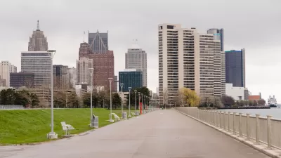
A new framework plan for Detroit's East Riverfront District will focus more on creating public spaces than a previous version of the plan. The proposed vision for the waterfront would expand Milliken State Park and create two new parks.

John Gallagher reports on a new plan for Detroit's east waterfront. "In a bold, new, and more democratic vision unveiled Wednesday evening, city planners showed off a blueprint to create three zones of public parkland on the riverfront where once private development had been scheduled to rise," writes Gallagher.
"The city also plans to create two new Dequindre Cut-style greenways down to the riverfront from the neighborhoods north of Jefferson Avenue to ease public access to the waterfront," adds Gallagher.
The article includes a photo gallery showing images of the current condition at the eastern waterfront, as well as renderings and plan views of the proposed vision for the waterfront.
Louis Aguilar provides additional news coverage of the proposed waterfront plan, along with another set of images. Skidmore Owings and Merrill, which contracted with the Detroit RiverFront Conservancy to generate the plan, also has set up a project page to explain more of the thinking behind the proposes planning vision.
FULL STORY: Detroit's riverfront plan includes a beach, more parks, fewer condos

Planetizen Federal Action Tracker
A weekly monitor of how Trump’s orders and actions are impacting planners and planning in America.

Maui's Vacation Rental Debate Turns Ugly
Verbal attacks, misinformation campaigns and fistfights plague a high-stakes debate to convert thousands of vacation rentals into long-term housing.

Restaurant Patios Were a Pandemic Win — Why Were They so Hard to Keep?
Social distancing requirements and changes in travel patterns prompted cities to pilot new uses for street and sidewalk space. Then it got complicated.

In California Battle of Housing vs. Environment, Housing Just Won
A new state law significantly limits the power of CEQA, an environmental review law that served as a powerful tool for blocking new development.

Boulder Eliminates Parking Minimums Citywide
Officials estimate the cost of building a single underground parking space at up to $100,000.

Orange County, Florida Adopts Largest US “Sprawl Repair” Code
The ‘Orange Code’ seeks to rectify decades of sprawl-inducing, car-oriented development.
Urban Design for Planners 1: Software Tools
This six-course series explores essential urban design concepts using open source software and equips planners with the tools they need to participate fully in the urban design process.
Planning for Universal Design
Learn the tools for implementing Universal Design in planning regulations.
Heyer Gruel & Associates PA
JM Goldson LLC
Custer County Colorado
City of Camden Redevelopment Agency
City of Astoria
Transportation Research & Education Center (TREC) at Portland State University
Jefferson Parish Government
Camden Redevelopment Agency
City of Claremont


