


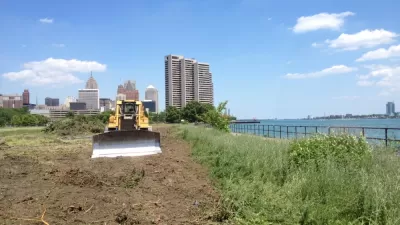
Following a plan to line the city's waterfront with redeveloped parkland, Detroit's 22-acre West Riverfront Park will incorporate concepts from a community-led design process.
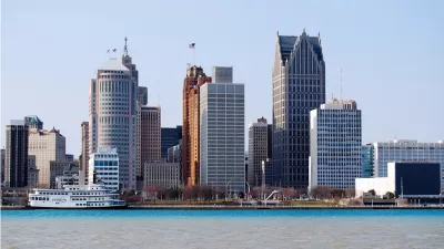
The Detroit Riverfront Conservancy (DRFC) is currently engaged in a planning process to add numerous parks and public spaces along the city's waterfront. Four competing firms have presented their plans for the West Riverfront Park. Ella Thorns writes, "The development of the 22-acre West Riverfront Park is expected to cost around $50 million to complete the DRFC's ultimate vision for 5.5 miles of revitalized riverfront."
"The four principal firms include Gustafson Guthrie Nichol (GGN), Hood Design Studio (HDS), James Corner Field Operations and Michael Van Valkenburgh and Associates (MVVA) collaborating with numerous Detroit and Michigan-based firms."
DRFC has taken steps to engage with the public as the design competition proceeds. The concepts incorporate input from a community advisory team of Detroit residents who visited similar parks in other cities. "There has been a further effort to involve the people of Detroit by organizing a public design exhibition to interact with the design concepts and once the winning proposal is selected there will be further opportunities for the community to view the rendering and models shape the final design."
FULL STORY: Detroit's Waterfront is Setting a Precedent for Community Led Architecture

Massive Private Gift to Fund Parks and Trails in Detroit, Buffalo
The gift is especially notable for its contributions toward efforts to redevelop Detroit's West Riverfront.

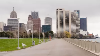
A New, Park-Filled Vision for Detroit's Waterfront
A new framework plan for Detroit's East Riverfront District will focus more on creating public spaces than a previous version of the plan. The proposed vision for the waterfront would expand Milliken State Park and create two new parks.
Shaping a 15-Minute City Vision for Detroit and Cleveland Using Data-Assisted Modeling
How master plans in the two cities hope to transform their historic, and historically underutilized, waterfronts.

Maui's Vacation Rental Debate Turns Ugly
Verbal attacks, misinformation campaigns and fistfights plague a high-stakes debate to convert thousands of vacation rentals into long-term housing.

Planetizen Federal Action Tracker
A weekly monitor of how Trump’s orders and actions are impacting planners and planning in America.

In Urban Planning, AI Prompting Could be the New Design Thinking
Creativity has long been key to great urban design. What if we see AI as our new creative partner?

Pedestrian Deaths Drop, Remain Twice as High as in 2009
Fatalities declined by 4 percent in 2024, but the U.S. is still nowhere close to ‘Vision Zero.’

King County Supportive Housing Program Offers Hope for Unhoused Residents
The county is taking a ‘Housing First’ approach that prioritizes getting people into housing, then offering wraparound supportive services.

Researchers Use AI to Get Clearer Picture of US Housing
Analysts are using artificial intelligence to supercharge their research by allowing them to comb through data faster. Though these AI tools can be error prone, they save time and housing researchers are optimistic about the future.
Urban Design for Planners 1: Software Tools
This six-course series explores essential urban design concepts using open source software and equips planners with the tools they need to participate fully in the urban design process.
Planning for Universal Design
Learn the tools for implementing Universal Design in planning regulations.
planning NEXT
Appalachian Highlands Housing Partners
Mpact (founded as Rail~Volution)
City of Camden Redevelopment Agency
City of Astoria
City of Portland
City of Laramie