


This summer, commuters may have another option for moving around Dubai as a pilotless drone is prepared to shuttle passengers around the city.

The Ehang 184 passenger drone will be the world's first passenger drone in operation this July if all goes as planned. Dezeen reports that Dubai's Roads and Transport Authority executive director Mattar al-Tayer announced plans at the World Government Summit to have the passenger-carrying drone begin flying across the city this summer. However, there are some limitations to the pilotless flights.
It can carry one passenger weighing up to 100 kilograms (220 pounds) and can stay airborne for 30 minutes on one charge....
There is no passenger override function, which means that anyone can travel in the drone without a pilot's license. However, this also means the user can't take control in an emergency.
The drone, developed by Chinese manufacturer Ehang, was first introduced last year at the Consumer Electronics Show in Las Vegas. The Arab News reports that the government of the United Arab Emirates is currently testing the drones. The flying passenger drone technology is part of a larger plan to make 25 percent of all trips in Dubai into driverless journeys by 2030, including the use of driverless minibuses and boats.
FULL STORY: Dubai to begin flying world's first passenger drone


COP28: Will Developed Nations Reduce Emissions?
Tensions between developed and developing nations surfaced over emissions and energy, with the former focused on reducing fossil fuels and the latter pointing to unrealized emissions reductions from the nations most responsible for global warming.

Largest Desalinated Water Reserve Ever Unveiled in Abu Dhabi
The UAE has created a storage facility under the desert that can provide up to 100 million liters per day in the event of an emergency.
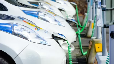
Dubai to Offer Free Parking and Charging to Electric Car Drivers
A city famous for its oil money is implementing generous incentives for electric cars.

Planetizen Federal Action Tracker
A weekly monitor of how Trump’s orders and actions are impacting planners and planning in America.

Congressman Proposes Bill to Rename DC Metro “Trump Train”
The Make Autorail Great Again Act would withhold federal funding to the system until the Washington Metropolitan Area Transit Authority (WMATA), rebrands as the Washington Metropolitan Authority for Greater Access (WMAGA).

DARTSpace Platform Streamlines Dallas TOD Application Process
The Dallas transit agency hopes a shorter permitting timeline will boost transit-oriented development around rail stations.

Downtown Los Angeles Gears Up for Growth
A new report highlights Downtown L.A.’s ongoing revival through major housing projects, adaptive reuse, hospitality growth, and preparations for global events in the years ahead.

Supreme Court Landlord Appeal Case Could Overturn Tenant Protections
A legal case claiming that COVID-era eviction moratoriums were unconstitutional could spell trouble for tenant protections.

Texas Moves to Curb Orphan Wells, But Critics Say Loopholes Remain
A proposed state law would shift financial responsibility for sealing unused drilling sites from the public to energy operators, though some advocates question its effectiveness due to industry-backed exemptions.
Urban Design for Planners 1: Software Tools
This six-course series explores essential urban design concepts using open source software and equips planners with the tools they need to participate fully in the urban design process.
Planning for Universal Design
Learn the tools for implementing Universal Design in planning regulations.
Municipality of Princeton
Roanoke Valley-Alleghany Regional Commission
City of Mt Shasta
City of Camden Redevelopment Agency
City of Astoria
Transportation Research & Education Center (TREC) at Portland State University
US High Speed Rail Association
City of Camden Redevelopment Agency
Municipality of Princeton (NJ)