


Street networks and city blocks, reduced to their fundamental attributes, reveal the vast differences between cities.
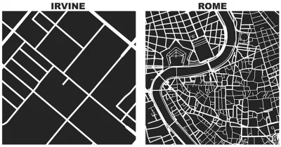
On his personal blog, Geoff Boeing, an urban planning PhD candidate at the University of California, Berkeley, has created a series of illustrations that allows easy comparison of the urban forms of cities as disparate as Rome and Irvine.
Inspired by Great Streets by Allan Jacobs, Boeing used Python and the OSMnx package he created for his dissertation. "With OSMnx we can download a street network from OpenStreetMap for anywhere in the world in just one line of code," explains Boeing.
Every image Boeing displays is cropped to one square mile—in cities like Portland, Irvine, Rome, Paris, and New York. The stark contrast of the images allows for "spatial objectivity," explains Boeing. The process is open source too—Boeing has placed examples and the code to reproduce these diagrams in OSMnx's GitHub repo.
FULL STORY: Square-Mile Street Network Visualization

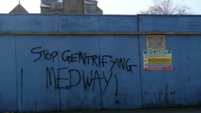
Friday Eye Candy: Turning Gentrification Data Into Art
Herwig Scherabon is a graphic designer featured this week in The Guardian.
Graphic Reveals Cardinal Orientation of Street Grids
Seth Kadish says he was born with an innate sense of direction. As such, he appreciates street grids oriented to cardinal directions. The phenomena interested him enough to create a graphic that visualizes the orientation of 12 urban areas.

Friday Eye Candy: AI Envisions Solutions to the Challenges Facing Cities
Phoenix reimagined for shade. Los Angeles as a place where everybody walks. San Francisco with affordable housing. AI makes a vision of the future possible.

Planetizen Federal Action Tracker
A weekly monitor of how Trump’s orders and actions are impacting planners and planning in America.

Restaurant Patios Were a Pandemic Win — Why Were They so Hard to Keep?
Social distancing requirements and changes in travel patterns prompted cities to pilot new uses for street and sidewalk space. Then it got complicated.

Map: Where Senate Republicans Want to Sell Your Public Lands
For public land advocates, the Senate Republicans’ proposal to sell millions of acres of public land in the West is “the biggest fight of their careers.”

Maui's Vacation Rental Debate Turns Ugly
Verbal attacks, misinformation campaigns and fistfights plague a high-stakes debate to convert thousands of vacation rentals into long-term housing.

San Francisco Suspends Traffic Calming Amidst Record Deaths
Citing “a challenging fiscal landscape,” the city will cease the program on the heels of 42 traffic deaths, including 24 pedestrians.

California Homeless Arrests, Citations Spike After Ruling
An investigation reveals that anti-homeless actions increased up to 500% after Grants Pass v. Johnson — even in cities claiming no policy change.
Urban Design for Planners 1: Software Tools
This six-course series explores essential urban design concepts using open source software and equips planners with the tools they need to participate fully in the urban design process.
Planning for Universal Design
Learn the tools for implementing Universal Design in planning regulations.
Heyer Gruel & Associates PA
JM Goldson LLC
Custer County Colorado
City of Camden Redevelopment Agency
City of Astoria
Transportation Research & Education Center (TREC) at Portland State University
Camden Redevelopment Agency
City of Claremont
Municipality of Princeton (NJ)