


Researchers at Harvard University have looked at multiple street grids around the country to identify what block size is the perfect length for walkability.

The Harvard Gazette spoke with Andres Sevtsuk, assistant professor of urban planning at the Harvard Graduate School of Design, about his research work looking at the connection between block length and what makes a walking-friendly environment. What the research finds is that in terms of a successful community that is pedestrian friendly, having blocks that are too small can prove detrimental.
The smaller your blocks, the more total perimeter you usually have. This perimeter could be activated through retail and commercial facades, and the more of that you have, the more animated or interesting an area tends to be. But if you take that to an extreme and have many tiny blocks, you start spending more time crossing streets instead of actually walking in front of stores. That’s where smaller is no longer better.
So what cities are doing it right? Sevtsuk's research finds that the blocks in Manhattan are very walkable—although, as stated above it involves more than just block size. While Portland, Oregon, Washington, D.C., Minneapolis, and Savannah, Georgia all have short blocks, they don't have the same density of pedestrian friendly destinations and activities that one finds in Manhattan.
FULL STORY: Why city blocks work


Meet NYC’s New Office of Livable Streets
The NYC DOT program will build on pandemic-era initiatives to promote safe and comfortable streets that enhance community and expand uses beyond just moving cars.

Report Reveals Proposed NYC Congestion Pricing Details
The draft proposal indicates most drivers would pay $15 to enter the Central Business District.
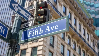
What Will Become of Fifth Avenue?
Visitors to the iconic shopping street overwhelmingly arrive by walking, transit, or bike. Why are bike and pedestrian infrastructure improvement lagging so far behind another famous NYC street, Broadway?

Maui's Vacation Rental Debate Turns Ugly
Verbal attacks, misinformation campaigns and fistfights plague a high-stakes debate to convert thousands of vacation rentals into long-term housing.

Planetizen Federal Action Tracker
A weekly monitor of how Trump’s orders and actions are impacting planners and planning in America.

In Urban Planning, AI Prompting Could be the New Design Thinking
Creativity has long been key to great urban design. What if we see AI as our new creative partner?

Massachusetts Budget Helps Close MBTA Budget Gap
The budget signed by Gov. Maura Healey includes $470 million in MBTA funding for the next fiscal year.

Milwaukee Launches Vision Zero Plan
Seven years after the city signed its Complete Streets Policy, the city is doubling down on its efforts to eliminate traffic deaths.

Portland Raises Parking Fees to Pay for Street Maintenance
The city is struggling to bridge a massive budget gap at the Bureau of Transportation, which largely depleted its reserves during the Civd-19 pandemic.
Urban Design for Planners 1: Software Tools
This six-course series explores essential urban design concepts using open source software and equips planners with the tools they need to participate fully in the urban design process.
Planning for Universal Design
Learn the tools for implementing Universal Design in planning regulations.
Gallatin County Department of Planning & Community Development
Heyer Gruel & Associates PA
JM Goldson LLC
City of Camden Redevelopment Agency
City of Astoria
Transportation Research & Education Center (TREC) at Portland State University
Jefferson Parish Government
Camden Redevelopment Agency
City of Claremont