


A new study shows how pollution and poverty can create a persistent cycle in poor neighborhoods.

Political expedience often pushes undesirable, but necessary, land uses out of rich neighborhoods. These coal stacks, prisons, and highway overpasses are what The Smart Growth Manual calls LULUs, or what Joe Cortright calls “disamenities” in a piece for City Commentary. "Poor neighborhoods tend to bear a disproportionate share of the exposure to environmental disamenities of all kinds," Cortright writes. Worse still, these disamenities tend to create a feedback loop. "If a neighborhood is highly polluted or crime-ridden, people with the economic wherewithal to move elsewhere typically will. When they abandon dirty or dangerous places, the rents fall, and by definition, the residents of these neighborhoods disproportionately become those who lack the resources to afford a better alternative: the poor," Cortright explains.
Sadly, all this is not new news to city watchers. What gives new perspective is a historical study from St. Andrew's University. "The study shows that variations in pollution levels are significant factors in explaining the distribution of poverty within cities in the 19th century," Cortright reports. One interesting insight from the study reveals why the East End was so often the poorer side of industrial cities. The idea investigated here is that in cities powered by coal, if the prevailing winds blew from West to East, that meant that pollution would be blown to the east side of town, causing issues that long outlasted the industrial revolution.
FULL STORY: Pollution and poor neighborhoods: A blast from the past

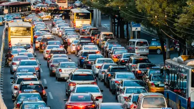
Cities Have Tried to Rein in Cars, and the Results Have Been Mixed
Vehicle pollution is making cities around the world unlivable. Some cities have taken steps to curb auto use and emissions, with varying levels of success.
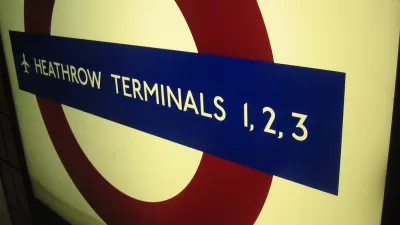
London's Mayor Takes Stand Against Airport Expansion
London Mayor Sadiq Khan has aligned himself with opponents to the addition of a third runway at London's Heathrow Airport, citing noise and air pollution concerns
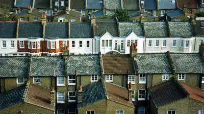
Report: Britain's Suburbs on the Decline
London's central core never experienced the deterioration many American downtowns lived through, but the inner city/suburb dynamic was still at play. Now poverty is moving outward.

Planetizen Federal Action Tracker
A weekly monitor of how Trump’s orders and actions are impacting planners and planning in America.

Maui's Vacation Rental Debate Turns Ugly
Verbal attacks, misinformation campaigns and fistfights plague a high-stakes debate to convert thousands of vacation rentals into long-term housing.

San Francisco Suspends Traffic Calming Amidst Record Deaths
Citing “a challenging fiscal landscape,” the city will cease the program on the heels of 42 traffic deaths, including 24 pedestrians.

Amtrak Rolls Out New Orleans to Alabama “Mardi Gras” Train
The new service will operate morning and evening departures between Mobile and New Orleans.

The Subversive Car-Free Guide to Trump's Great American Road Trip
Car-free ways to access Chicagoland’s best tourist attractions.

San Antonio and Austin are Fusing Into one Massive Megaregion
The region spanning the two central Texas cities is growing fast, posing challenges for local infrastructure and water supplies.
Urban Design for Planners 1: Software Tools
This six-course series explores essential urban design concepts using open source software and equips planners with the tools they need to participate fully in the urban design process.
Planning for Universal Design
Learn the tools for implementing Universal Design in planning regulations.
Heyer Gruel & Associates PA
JM Goldson LLC
Custer County Colorado
City of Camden Redevelopment Agency
City of Astoria
Transportation Research & Education Center (TREC) at Portland State University
Jefferson Parish Government
Camden Redevelopment Agency
City of Claremont