


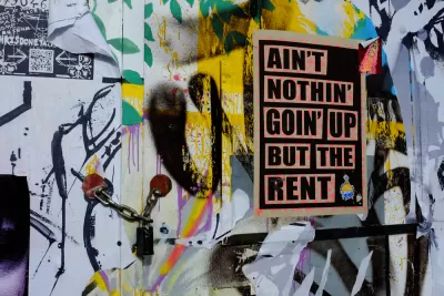
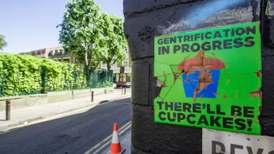
New research finds evidence of racial "boundary movements," in older, denser U.S. cities. The research explains more about why gentrification feels like such a powerful force, for those experiencing its effects.
Ryan Briggs shares news of a study written by Jonathan Tannen, for his dissertation at Princeton University. Tannen's research uses a Bayesian modeling system to detect racial borders in the 100 largest U.S. cities, quantifying "the invisible lines of segregation."
Briggs summarizes one of the key findings of the research: "As more suburban whites moved back to urban areas, old racial boundaries were moving, and spreading outward. But the neighborhoods themselves weren’t desegregating." Instead, the process of neighborhood change discovered by Tannen is better described as resegregation, according to Briggs.
Tannen found evidence of these boundary movements in cities like Chicago, New York, and Boston. "But interestingly, and potentially uncomfortably for proponents of walkable urbanism, the phenomenon was only apparent In auto-centric cities, gentrification was more diffuse, and racial boundaries were less clear," according to Briggs.
However, none of Tannen's study amounts to a final say on the impacts of gentrification. Briggs is careful to note the limitations of the research, and other studies that find evidence of the limitations of gentrification and its displacement effects.
FULL STORY: When 'Gentrification' Is Really a Shift in Racial Boundaries


The Gentrification Effect of Urban Parks
New research finds that different types of parks correlate with different gentrification effects, adding to the complexity of urban change.
Review: 'The Handbook of Gentrification Studies'
A book by Loretta Lees and Martin Phillips, published in 2018, is reviewed and recommended to "graduates studying anthropology of cities, urbanism, geography, and new urban identities."
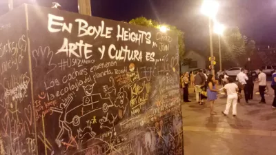
Why L.A.'s Boyle Heights Matters to Anti-Gentrification Activists
The historically Latino working class neighborhood is a frequent touchstone in debates over gentrification in Los Angeles. That history goes back decades and colors residents' perceptions.

Maui's Vacation Rental Debate Turns Ugly
Verbal attacks, misinformation campaigns and fistfights plague a high-stakes debate to convert thousands of vacation rentals into long-term housing.

Planetizen Federal Action Tracker
A weekly monitor of how Trump’s orders and actions are impacting planners and planning in America.

In Urban Planning, AI Prompting Could be the New Design Thinking
Creativity has long been key to great urban design. What if we see AI as our new creative partner?

Cal Fire Chatbot Fails to Answer Basic Questions
An AI chatbot designed to provide information about wildfires can’t answer questions about evacuation orders, among other problems.

What Happens if Trump Kills Section 8?
The Trump admin aims to slash federal rental aid by nearly half and shift distribution to states. Experts warn this could spike homelessness and destabilize communities nationwide.

Sean Duffy Targets Rainbow Crosswalks in Road Safety Efforts
Despite evidence that colorful crosswalks actually improve intersection safety — and the lack of almost any crosswalks at all on the nation’s most dangerous arterial roads — U.S. Transportation Secretary Duffy is calling on states to remove them.
Urban Design for Planners 1: Software Tools
This six-course series explores essential urban design concepts using open source software and equips planners with the tools they need to participate fully in the urban design process.
Planning for Universal Design
Learn the tools for implementing Universal Design in planning regulations.
Appalachian Highlands Housing Partners
Gallatin County Department of Planning & Community Development
Heyer Gruel & Associates PA
Mpact (founded as Rail~Volution)
City of Camden Redevelopment Agency
City of Astoria
City of Portland
City of Laramie