The New Yorker has produced a video comparing the streets of Downtown Los Angeles on either side of a 70-year span of history.


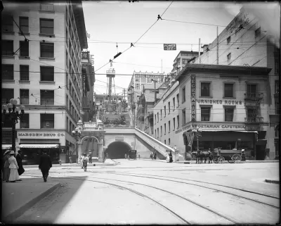
Aimee Custis shares news of a New Yorker video that provides a side-by-side comparison of the streets of Downtown Los Angeles between the 19040s and today.
The tour takes different views of Bunker Hill, mostly while traveling along Grand Avenue, the infamous site of the city's largest acts of urban renewal. City Hall is visible at 0:34 in both frames, and the Frank Gehry-designed Disney Music Hall comes into view in the view of today's L.A. at 0:40. The famous Biltmore Hotel survived the entire 70-year span of this video comparison, as visible at 2:18, and the city's Central Library comes into view on both screens at 2:31. The disruption of the street grid in the intervening years is also documented beginning at 2:59.
Custis, writing for Greater Greater Washington, makes the point that "[w]hile this video is of LA, one can imagine a similar then-and-now for DC."
Read the full story: Seventy Years of Los Angeles, Then and Now


LA needs $2 billion in Olympic Games transportation funding by Sept. 1, officials say
Congresspeople who serve the Los Angeles area met on Aug. 26 to urge the Trump administration to speed up funding.
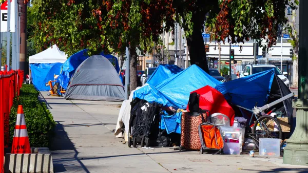
Los Angeles rescinds twelve 'anti-camping zones'
The zones previously prohibited unhoused people from camping in parts of Hollywood.

Los Angeles County gained more than 10,000 ADUs in 2025 — and barely made a dent in its housing goals
A new study warns that the burst in ADU development will not be enough to remedy Los Angeles’ affordable housing gap.

Planetizen Federal Action Tracker
A weekly monitor of how Trump’s orders and actions are impacting planners and planning in America.

The state-sanctioned urbicide of Austin
People don’t kill cities. Freeways do.

US to reduce Colorado River water deliveries to Mexico
A new Colorado Treaty amendment reduces Mexico’s Colorado River water allocation by 250,000 acre feet.

Nation's most wind-powered state turns to coal as data centers increase energy demand
For the first time in decades, Iowa has increased its generation of coal power.

NYC cools commuters with city's first rain garden above a bus stop
New York City officials say the plants in the rain garden can absorb 16 gallons of rainwater during heavy storms.

Brightline West’s future may rely on $6 billion federal loan
The company has until Nov. 2 to make a $400 million equity investment into its proposed high-speed rail line.

FREE Course: Walkable City 1: Why Walkability?
After describing his path towards focusing on walkability as the essence of good planning, Jeff Speck marches through his five principal reasons for making more walkable places.
Reinventing Malls: Planning Alchemy—Turning Gray Fields Into Gold
The course focuses on the opportunities and imperatives that shape reinvention of mall sites.

.jpg)
Greater Baltimore Committee
Eagle County Government
Harvard University Graduate School of Design
The Architects Foundation
University of Cincinnati Online
The Pocatello Development Authority
The Urban Renewal Agency of the City of Pocatello
Journal of the American Planning Association