


Concepts like erasure, greenfield development, and easements figure into this story about a rural community on the fringes of suburban development in Maryland's Montgomery County.

"The 'Farm Road' case in Maryland’s Montgomery County is a troubling example of rural gentrification and historical erasure," according to an article by David Rotenstein.
The process of rural gentrification described is the result of a widening "gap in the low value of the property as agricultural versus a potential greater value if it were to be developed," according to Rotenstein. The "rent gap" in rural communities means that working-class residents are at risk of displacement—just as they would be under similar circumstances in urban areas.
After introducing the concept of rural gentrification, as described above, Rotenstein goes on to examine the example of a community formed around the "Farm Road" in Montgomery County—a "historically African American community created by freed slaves who bought land and cultivated farms near Sandy Spring, about 30 miles north of the U.S. Capitol."
The Farm Road at the center of the controversy was a vernacular place name for a route that emerged "over more than a century of agricultural use," but not as a dedicated public right-of-way. In other words, Farm Road didn't exist, which precipitated decisions by the Montgomery County Planning Department to claim that addresses along the road also didn't exist. That lowered property values for homes along the road and led to disputes between local residents and the planning department, as well as local residents and the residents of nearby developments.
Rotenstein provides more details about the legal fallout from the controversy, which most recently included a ruling by the Maryland Court of Appeals that went against the residents of Farm Road. An article from 2008 by Margie Hyslop provides more details about the controversy as it unfolded.
FULL STORY: Farm Road: Rural gentrification and the erasure of history

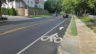
On Foot: Planners Complete Street Safety Inventory One Step at a Time
Before drafting a new Pedestrian Master Plan for Montgomery County, planners are creating a detailed inventory of street conditions by walking every single one fo the county's roads and streets.

First for Montgomery County: A Pedestrian Master Plan
Planners in Montgomery County, Maryland, one of the most famous suburban regions in the country, will produce the first-ever pedestrian master plan for the county.
Montgomery County Planners Target 4,2000 New Housing Units
The Montgomery County Planning Department is making the case for more housing to meet the growing number of jobs in the county.

Planetizen Federal Action Tracker
A weekly monitor of how Trump’s orders and actions are impacting planners and planning in America.

Vehicle-related Deaths Drop 29% in Richmond, VA
The seventh year of the city's Vision Zero strategy also cut the number of people killed in alcohol-related crashes by half.

As Trump Phases Out FEMA, Is It Time to Flee the Floodplains?
With less federal funding available for disaster relief efforts, the need to relocate at-risk communities is more urgent than ever.

Berkeley Approves ‘Middle Housing’ Ordinance
The city that invented single-family zoning is finally reckoning with its history of exclusion.

SEPTA Budget Slashes Service by 45 Percent
The Philadelphia-area transit agency is legally tasked with maintaining a balanced budget. Officials hope the state will come to the rescue with additional funding.

Connecticut Governor Vetoes Housing Bill
Gov. Lamont reversed his view on a controversial affordable housing bill that would have required municipalities to zone for set amounts of affordable housing to receive state funding.
Urban Design for Planners 1: Software Tools
This six-course series explores essential urban design concepts using open source software and equips planners with the tools they need to participate fully in the urban design process.
Planning for Universal Design
Learn the tools for implementing Universal Design in planning regulations.
Heyer Gruel & Associates PA
JM Goldson LLC
Custer County Colorado
City of Camden Redevelopment Agency
City of Astoria
Transportation Research & Education Center (TREC) at Portland State University
Camden Redevelopment Agency
City of Claremont
Municipality of Princeton (NJ)