


Yonah Freemark provides a comprehensive explainer of the nuts and bolts of population analysis, applying that expertise to an examination of downtown population change.

Yonah Freemark writes an in-depth explainer post about population changes around the United States. Before beginning with an analysis of downtown populations, Freemark describes in clear detail his methodology. The introductory passage thus has a lot to teach about the benefits and shortcomings of the tools available for demographic analysis, which have advantages and disadvantages at every level (i.e., region, county, city, tract/block/block group).
Then, Freemark "delves into the question of how to measure population growth in urban environments by examining frequently used measures of demographic change and comparing them to alternatives," because "the question of what cities are growing and what cities aren’t is at the core of some of the most pressing debates in today’s urban planning–so understanding how a place’s population change is occurring is essential."
The post digs into his analysis to produce findings about the downtown areas of cities like Los Angeles, Las Vegas, Houston, Indianapolis, and New York City, among others, and some general trends from cities around the country. On that latter count, this passage is just one of the many important revelations and explanations from the article:
The U.S. has gained more than 140 million people since 1960, and the growth of its largest cities has at least to some degree corresponded to that; the total population of the 100 largest cities in 1960 grew from 47.5 million then to 57.4 million in 2014. Yet this growth has come largely through annexation and not through infill development or construction downtown…
Though taking a different route to the conclusion, that claim also supports another recent article debunking the commonly cited statistic that half of humans live in "cities." Freemark's post is thus another productive move to reorient the discussion about city growth.
FULL STORY: Reorienting our discussion of city growth

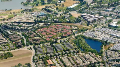
The Return of Suburbanization
The "back to the city" movement of the past decade or so could prove to be the outlier, as Census data shows population growth slowing in the biggest cities while suburban areas lead population growth in more metropolitan areas.

Census Data: Growth Trends Favor Sunbelt Cities
Although city growth continues to outpace the suburbs, the nation's three largest cities are experiencing a growth slowdown. Sunbelt cities like Austin and Orlando are picking up the slack.

Renters Now Outnumber Homeowners in Over 200 US Suburbs
High housing costs in city centers and the new-found flexibility offered by remote work are pushing more renters to suburban areas.

Maui's Vacation Rental Debate Turns Ugly
Verbal attacks, misinformation campaigns and fistfights plague a high-stakes debate to convert thousands of vacation rentals into long-term housing.

Planetizen Federal Action Tracker
A weekly monitor of how Trump’s orders and actions are impacting planners and planning in America.

In Urban Planning, AI Prompting Could be the New Design Thinking
Creativity has long been key to great urban design. What if we see AI as our new creative partner?

Portland Raises Parking Fees to Pay for Street Maintenance
The city is struggling to bridge a massive budget gap at the Bureau of Transportation, which largely depleted its reserves during the Civd-19 pandemic.

Spokane Mayor Introduces Housing Reforms Package
Mayor Lisa Brown’s proposals include deferring or waiving some development fees to encourage more affordable housing development.

Houston Mayor Kills Another Bike Lane
The mayor rejected a proposed bike lane in the Montrose district in keeping with his pledge to maintain car lanes.
Urban Design for Planners 1: Software Tools
This six-course series explores essential urban design concepts using open source software and equips planners with the tools they need to participate fully in the urban design process.
Planning for Universal Design
Learn the tools for implementing Universal Design in planning regulations.
Gallatin County Department of Planning & Community Development
Heyer Gruel & Associates PA
JM Goldson LLC
City of Camden Redevelopment Agency
City of Astoria
Transportation Research & Education Center (TREC) at Portland State University
Jefferson Parish Government
Camden Redevelopment Agency
City of Claremont