


A web tool that helped Detroit develop a housing plan may ultimately provide public data on every parcel in the country.
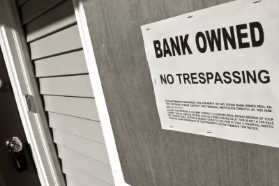
In the early stages of developing a housing recovery and blight reduction plan, a grant allowed Loveland Technologies to digitize and map information on every parcel in the city. The resulting web tool, Motor City Mapping, helped the Detroit Land Bank Authority grasp the scale of the crisis by highlighting the number of abandoned and blighted properties.
Now, with help from the Western Reserve Land Conservancy and another grant, Loveland is developing similar dashboards for the cities of Columbus, Cleveland, and Cincinnati.
The company's vision is to digitize information on every parcel in the United States—creating a publicly accessible national parcel data layer.
"By creating a one-stop shop for parcel information, civic leaders have property data at their fingertips that they can use to make smart decisions on development," the Washington Post explains, while public access to the same data creates "a more level field" for residents and neighborhood groups to advocate for community needs.
Residents can also be involved in creating the maps themselves: Loveland invites the public to help survey their city by submitting pictures and information to the dashboard via a smartphone app.
In the past, Loveland founder Jerry Paffendorf sold square-inch 'microplots' for $1 in hopes of encouraging online community engagement.
FULL STORY: One of the first steps in tackling Detroit’s housing crisis? Mapping it.


60 Years of Midwestern Urban Renewal
Researchers at the Institute for Quality Communities at the University of Oklahoma prepared a set of images to show the indelible impact of mid-20th century urban renewal on Midwestern cities.
Bike-Share Spreads Across Sprawling Midwest
Bike-share is continuing its march towards world domination, with seemingly every large Midwestern American city now jumping on the bike lending bandwagon, reports Angie Schmitt.
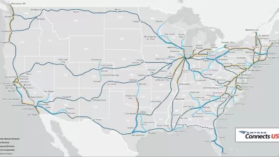
Political Support for Amtrak’s All Aboard Ohio Plans Follows Federal Infrastructure Funding
Gov. Mike DeWine’s sudden interest in working with Amtrak might have something to do with $66 billion in Infrastructure Investment and Jobs Act funding recently announced by the Federal Railroad Administration.

Planetizen Federal Action Tracker
A weekly monitor of how Trump’s orders and actions are impacting planners and planning in America.

San Francisco's School District Spent $105M To Build Affordable Housing for Teachers — And That's Just the Beginning
SFUSD joins a growing list of school districts using their land holdings to address housing affordability challenges faced by their own employees.

The Tiny, Adorable $7,000 Car Turning Japan Onto EVs
The single seat Mibot charges from a regular plug as quickly as an iPad, and is about half the price of an average EV.

As Trump Phases Out FEMA, Is It Time to Flee the Floodplains?
With less federal funding available for disaster relief efforts, the need to relocate at-risk communities is more urgent than ever.

With Protected Lanes, 460% More People Commute by Bike
For those needing more ammo, more data proving what we already knew is here.

In More Metros Than You’d Think, Suburbs are Now More Expensive Than the City
If you're moving to the burbs to save on square footage, data shows you should think again.
Urban Design for Planners 1: Software Tools
This six-course series explores essential urban design concepts using open source software and equips planners with the tools they need to participate fully in the urban design process.
Planning for Universal Design
Learn the tools for implementing Universal Design in planning regulations.
Smith Gee Studio
City of Charlotte
City of Camden Redevelopment Agency
City of Astoria
Transportation Research & Education Center (TREC) at Portland State University
US High Speed Rail Association
City of Camden Redevelopment Agency
Municipality of Princeton (NJ)