


A new guide helps communities set up groups that can help analyze their neighborhood data and put it to good use.

"Local data intermediaries" work with raw government data to produce accessible neighborhood indicators, which residents and stakeholders can use to fuel the changes and improvements communities want to see.
A guide to creating the intermediaries was published May 31 by National Neighborhood Indicators Partnership (NNIP)—a network of more than 20 such groups—and the Urban Institute.
Two scholars from the Institute explain in Next City that liaising between government and communities requires "trust, technical expertise, knowledge of the local context and coordination among multiple stakeholders." But if successful, they say, intermediaries can help "surface, explain and address the issues distressed communities face."
They give special note to NNIP's Baltimore chapter, which was able to add to the national discussion about the 2015 death of Freddie Gray in police custody by drawing on 15 years' worth of data about his neighborhood.
FULL STORY: Your City Needs a Local Data Intermediary Now

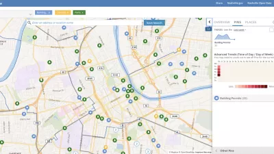
Presenting Municipal Data in an Interactive Map, Nashville Style
The city of Nashville launched the NashView interactive data map earlier this month.

How London's Leading on Transit Data
Transport for London is forging ahead on several projects to collect and use more rider data. One initiative draws on WiFi connections to map users' paths through the London Underground.

Los Angeles' Chief Technology Officer Helped to Connect City on Transit and Transparency
Chief Innovative Technology Officer of Los Angeles, Peter Marx, recently stepped down. But first, he offers some lessons learned during his tenure, which included an L.A. mobility app and a successful open data initiative.

Maui's Vacation Rental Debate Turns Ugly
Verbal attacks, misinformation campaigns and fistfights plague a high-stakes debate to convert thousands of vacation rentals into long-term housing.

Planetizen Federal Action Tracker
A weekly monitor of how Trump’s orders and actions are impacting planners and planning in America.

San Francisco Suspends Traffic Calming Amidst Record Deaths
Citing “a challenging fiscal landscape,” the city will cease the program on the heels of 42 traffic deaths, including 24 pedestrians.

Defunct Pittsburgh Power Plant to Become Residential Tower
A decommissioned steam heat plant will be redeveloped into almost 100 affordable housing units.

Trump Prompts Restructuring of Transportation Research Board in “Unprecedented Overreach”
The TRB has eliminated more than half of its committees including those focused on climate, equity, and cities.

Amtrak Rolls Out New Orleans to Alabama “Mardi Gras” Train
The new service will operate morning and evening departures between Mobile and New Orleans.
Urban Design for Planners 1: Software Tools
This six-course series explores essential urban design concepts using open source software and equips planners with the tools they need to participate fully in the urban design process.
Planning for Universal Design
Learn the tools for implementing Universal Design in planning regulations.
Heyer Gruel & Associates PA
JM Goldson LLC
Custer County Colorado
City of Camden Redevelopment Agency
City of Astoria
Transportation Research & Education Center (TREC) at Portland State University
Jefferson Parish Government
Camden Redevelopment Agency
City of Claremont