


Transport for London is forging ahead on several projects to collect and use more rider data. One initiative draws on WiFi connections to map users' paths through the London Underground.
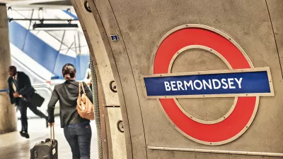
As Zulfikar Abbany writes, the last several decades have seen marked improvements in London's transit network. Data initiatives are one reason why. "It started with ticketing data - things like the Oyster Card, a simple 'tap on, tap off' payment system that has given Transport for London (TfL) masses of data on customer behavior. And they have gone from that to a trial in late 2016 that used WiFi in underground station to monitor the way people move within station, how they make connections, and how that can lead to - or avoid - overcrowding."
Abbany takes comment from Lauren Sager Weinstein, TfL's Chief Data Officer, who is well aware of privacy concerns. According to Weinstein, "We took the principle of data minimization [...] So you only take the data that you need to take. You don't collect more than you need for [your stated] reason. And we were very transparent about it, so customers could opt-out if they didn't want to participate."
In addition to methods like WiFi tracking, TfL maintains an open data policy letting third parties "extend the reach" of the system using certain datasets. The policy has yielded dividends. "A recent study by Deloitte, a financial consultancy, suggests TfL's open data policy was generating annual economic benefits and savings of up to £130 million (145 million euros) for travelers and the authority itself."
FULL STORY: A public transport model built on open data


This is How the British Started Cycling More
Cycling has never felt more relevant or encouraged in the UK. Since May, the London Councils have upgraded 60 km of bike lanes in the capital city, added 20,000 square metres of extra pavement space, and installed 1,500+ additional cycle parking.

For Transit to Better Serve Women, More Data Needed
Understanding how women use transit does not just help make systems more equitable. It also guides policy and planning changes that benefit all riders.
What Will Become of London's Transit Megaproject After Brexit?
London's Crossrail promises faster commutes and neighborhood revitalization in a global economic hub. But what if Brexit puts a damper on that future?

Maui's Vacation Rental Debate Turns Ugly
Verbal attacks, misinformation campaigns and fistfights plague a high-stakes debate to convert thousands of vacation rentals into long-term housing.

Planetizen Federal Action Tracker
A weekly monitor of how Trump’s orders and actions are impacting planners and planning in America.

Chicago’s Ghost Rails
Just beneath the surface of the modern city lie the remnants of its expansive early 20th-century streetcar system.

Bend, Oregon Zoning Reforms Prioritize Small-Scale Housing
The city altered its zoning code to allow multi-family housing and eliminated parking mandates citywide.

Amtrak Cutting Jobs, Funding to High-Speed Rail
The agency plans to cut 10 percent of its workforce and has confirmed it will not fund new high-speed rail projects.

LA Denies Basic Services to Unhoused Residents
The city has repeatedly failed to respond to requests for trash pickup at encampment sites, and eliminated a program that provided mobile showers and toilets.
Urban Design for Planners 1: Software Tools
This six-course series explores essential urban design concepts using open source software and equips planners with the tools they need to participate fully in the urban design process.
Planning for Universal Design
Learn the tools for implementing Universal Design in planning regulations.
planning NEXT
Appalachian Highlands Housing Partners
Mpact (founded as Rail~Volution)
City of Camden Redevelopment Agency
City of Astoria
City of Portland
City of Laramie