


One of the national centers of authority for street design is onboard with trends already in motion in local jurisdictions all over the United States. So let it be written; so let it be done?
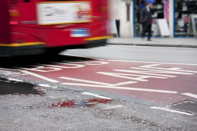
"The National Association of City Transportation Officials [NACTO] has released a new design guide to help cities prioritize transit on their streets," reports Angie Schmitt. The new Transit Street Design Guide, as it's called, elaborates on ideas first legitimized by NACTO in 2013 with the Urban Street Design Guide. Schmitt offers insight into a few of the fine points made in the new guide, citing examples of illustrations and other infographics from the new guide.
FULL STORY: A New Blueprint for Streets That Put Transit Front and Center


Remaking the Streets of Milwaukee for Bikes and a Changing Population
The city of Milwaukee is repairing its streets and making them more bike and pedestrian friendly in the process.
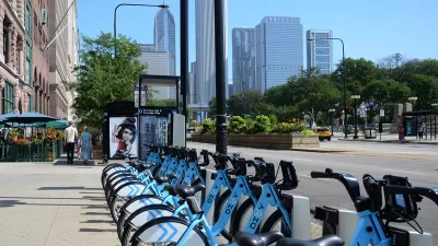
A New Guide for Siting Bikeshare Stations
The National Association of City Transportation Officials (NACTO) is on a multi-modal roll, releasing two guides to non-automobile forms of transportation in recent weeks. The most recent offers guidance on why, where, and how to site bikeshare.
Research: More Complex Streets Are Safer
Streets that offer more perceived obstacles and distractions can force drivers to slow down and drive more carefully.

Planetizen Federal Action Tracker
A weekly monitor of how Trump’s orders and actions are impacting planners and planning in America.

Chicago’s Ghost Rails
Just beneath the surface of the modern city lie the remnants of its expansive early 20th-century streetcar system.

San Antonio and Austin are Fusing Into one Massive Megaregion
The region spanning the two central Texas cities is growing fast, posing challenges for local infrastructure and water supplies.

Since Zion's Shuttles Went Electric “The Smog is Gone”
Visitors to Zion National Park can enjoy the canyon via the nation’s first fully electric park shuttle system.

Trump Distributing DOT Safety Funds at 1/10 Rate of Biden
Funds for Safe Streets and other transportation safety and equity programs are being held up by administrative reviews and conflicts with the Trump administration’s priorities.

German Cities Subsidize Taxis for Women Amid Wave of Violence
Free or low-cost taxi rides can help women navigate cities more safely, but critics say the programs don't address the root causes of violence against women.
Urban Design for Planners 1: Software Tools
This six-course series explores essential urban design concepts using open source software and equips planners with the tools they need to participate fully in the urban design process.
Planning for Universal Design
Learn the tools for implementing Universal Design in planning regulations.
planning NEXT
Appalachian Highlands Housing Partners
Mpact (founded as Rail~Volution)
City of Camden Redevelopment Agency
City of Astoria
City of Portland
City of Laramie