


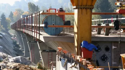
Seattle is in the process of drafting a $27 billion transit funding initiative for the November 2016 ballot.
Sound Transit is in the process of planning out the proposals included in the Sound Transit 3 (ST3) regional transit expansion initiative. Josh Feit has been following along with the public hearings about the options, while Sound Transit continues to solicit ideas for the initiative online.
In an article earlier in December, Feit reports from a Sound Transit Board hearing, in which staff presented the board with a third option for a line between Ballard and Tacoma to potentially include in ST3. The hearing, and the proposal, also prompted coverage from Mike Lindblom at The Seattle Times and Zach Shaner at Seattle Transit Blog. All three of the articles provide a lot of details about "Option 3."
A later post by Feit noticed another component of ST3: "Nearly $1 billion for potential new parking stalls, including 'Expanded parking capacity of 4,000 structured stalls' in one project alone in the Southern portion of ST3 to provide access to Sounder trains." That's not the only parking investment currently in the proposal: "There’s also park-and-rides like the potential 600-stall park-and-ride at Canyon Park in the Lynnwood-to-Bellevue Line in the Eastern corridor, and garages such as a 1,240-stall garage at the Star Lake station as part of Federal Way Link in the Southern corridor."
FULL STORY: Unusually Opinionated Sound Transit Staff Presents New Ballard-to-Tacoma Light Rail Option

New Details on Seattle's $50 Billion Light Rail Plan
The campaign for the Sound Transit 3 ballot initiative is underway in Seattle, after local officials released a draft plan that charts a $50 billion build out of light rail in the region.
Details of the Seattle's Big ST3 Light Rail Plan
The $54 billion ST3 plan would add 62 miles of light rail over 25 years.
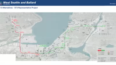
Checking in on the Progress of the Sound Transit 3 Plan
The Seattle area's $53.8 billion transit expansion plan is moving along in fits and starts.

Maui's Vacation Rental Debate Turns Ugly
Verbal attacks, misinformation campaigns and fistfights plague a high-stakes debate to convert thousands of vacation rentals into long-term housing.

Planetizen Federal Action Tracker
A weekly monitor of how Trump’s orders and actions are impacting planners and planning in America.

In Urban Planning, AI Prompting Could be the New Design Thinking
Creativity has long been key to great urban design. What if we see AI as our new creative partner?

Florida Seniors Face Rising Homelessness Risk
High housing costs are pushing more seniors, many of them on a fixed income, into homelessness.

Massachusetts Budget Helps Close MBTA Budget Gap
The budget signed by Gov. Maura Healey includes $470 million in MBTA funding for the next fiscal year.

Milwaukee Launches Vision Zero Plan
Seven years after the city signed its Complete Streets Policy, the city is doubling down on its efforts to eliminate traffic deaths.
Urban Design for Planners 1: Software Tools
This six-course series explores essential urban design concepts using open source software and equips planners with the tools they need to participate fully in the urban design process.
Planning for Universal Design
Learn the tools for implementing Universal Design in planning regulations.
Gallatin County Department of Planning & Community Development
Heyer Gruel & Associates PA
JM Goldson LLC
City of Camden Redevelopment Agency
City of Astoria
Transportation Research & Education Center (TREC) at Portland State University
Jefferson Parish Government
Camden Redevelopment Agency
City of Claremont