


Cartographers have a new world to map, as technology opens up the interiors of malls, museums, and other large spaces to online exploration.
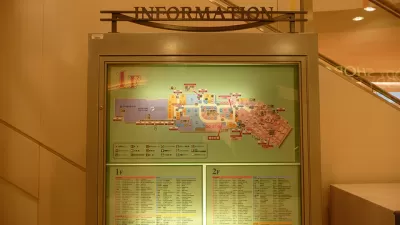
CityMetric reports on the efforts by Google to start mapping the interior of buildings, which presents a whole new area of exploration for cartographers. Sending people into large venues wearing a rucksack contraption, Google is able to map the interior of spaces such as the British Museum in London, allowing viewers to move from the museum’s basement level to the fifth floor to find the location of specific exhibits.
Google has used the rucksack to build up a growing list of indoor maps... Most are large indoor venues, museums or shopping centres – places which often offer their own floorplan maps thanks to their size and the number of services on offer. It makes sense that these maps would eventually transfer to the digital arena, just as outdoor maps have.
Apple appears to be getting into the indoor mapping space as well, launching the “Indoor Survey App”, which CityMetric notes is accessible only through a direct link to the app’s page. “According to the app description, it allows users to map indoor spaces by ‘dropping points’.”
Moving beyond the 2D limitations of Google and Apple Maps, Harvard University is partnering with the Redlands, California-based SmarterBetterCiities to create 3D interior maps of the Harvard campus. SmarterBetterCities uses ESRI’s ArcGIS platform to create 3D models of interior spaces, such as a map prepared for the ESRI User Conference in the San Diego Convention Center, viewable here.
FULL STORY: Why the indoors could be the next frontier for map-makers


Friday Funny: Cartographers Are Hiding an Idyllic Continent
The rest of the world would only spoil it for the mapmakers.

Friday Eye Candy: Charting Road Maps By Hand
In the days before Google Maps, when AAA TripTiks and Thomas Guides ruled the planet…
Friday Eye Candy: Highly Detailed Cold War Era Soviet Maps of the U.S.
A new book sheds light on maps created by cartographers in the Soviet Union that dove into remarkable detail about buildings, transportation networks, and other infrastructure in cities across the United States and around the world.

Planetizen Federal Action Tracker
A weekly monitor of how Trump’s orders and actions are impacting planners and planning in America.

San Francisco's School District Spent $105M To Build Affordable Housing for Teachers — And That's Just the Beginning
SFUSD joins a growing list of school districts using their land holdings to address housing affordability challenges faced by their own employees.

The Tiny, Adorable $7,000 Car Turning Japan Onto EVs
The single seat Mibot charges from a regular plug as quickly as an iPad, and is about half the price of an average EV.

Seattle's Plan for Adopting Driverless Cars
Equity, safety, accessibility and affordability are front of mind as the city prepares for robotaxis and other autonomous vehicles.

As Trump Phases Out FEMA, Is It Time to Flee the Floodplains?
With less federal funding available for disaster relief efforts, the need to relocate at-risk communities is more urgent than ever.

With Protected Lanes, 460% More People Commute by Bike
For those needing more ammo, more data proving what we already knew is here.
Urban Design for Planners 1: Software Tools
This six-course series explores essential urban design concepts using open source software and equips planners with the tools they need to participate fully in the urban design process.
Planning for Universal Design
Learn the tools for implementing Universal Design in planning regulations.
Smith Gee Studio
City of Charlotte
City of Camden Redevelopment Agency
City of Astoria
Transportation Research & Education Center (TREC) at Portland State University
US High Speed Rail Association
City of Camden Redevelopment Agency
Municipality of Princeton (NJ)