


It's simple, according to this Washington Post column: better buses make a better city.
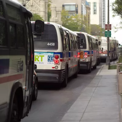
"Imagine being at almost any major corner or commercial center of the region and knowing a fast and reliable vehicle will soon arrive to whisk you in the direction you want to go for a low cost," begins an article by David Alpert, writing for The Washington Post.
Not everyone—namely, those who don't live near rail stops—have "that kind of freedom" says Alpert. But they could. "[A] certain technology can provide this: the bus. All it takes is the political will to modify our streets and traffic signals to make the bus frequent, attractive, reliable and speedy."
Alpert notes the big bus projects at various stages of planning and implementation in the Washington, D.C. metropolitan area, including Virginia's Metroway, the District Department of Transportation's 16th Street S Line, plans for a Bus Rapid Transit line in Montgomery County, and planning efforts in Prince George's County [pdf], Howard County [pdf], and the cities of Alexandria and Fairfax.
Alpert goes on to cite a lack of political will as the largest obstacle to doing what it really takes to improve bus transit, in addition to laying out a variety of arguments for why bus transit should be a central consideration in the future of mobility.
FULL STORY: Better buses make a better city

ADU Results Fall Short of Intentions in D.C. Region
Accessory dwelling unit regulations vary but results are consistently underwhelming in the D.C. region.
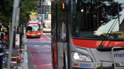
Watch D.C.'s New Red Bus Lanes in Action
Streetfilms documents the early results of an ambitious transit pilot project in Washington, D.C.

Bus Rapid Transit, Bike Lanes Under Consideration in Alexandria, Virginia
A complete streets makeover is taking shape for Duke Street in Alexandria.

Planetizen Federal Action Tracker
A weekly monitor of how Trump’s orders and actions are impacting planners and planning in America.

Congressman Proposes Bill to Rename DC Metro “Trump Train”
The Make Autorail Great Again Act would withhold federal funding to the system until the Washington Metropolitan Area Transit Authority (WMATA), rebrands as the Washington Metropolitan Authority for Greater Access (WMAGA).

DARTSpace Platform Streamlines Dallas TOD Application Process
The Dallas transit agency hopes a shorter permitting timeline will boost transit-oriented development around rail stations.

Parks: Essential Community Infrastructure — and a Smart Investment
Even during times of budget constraint, continued investment in parks is critical, as they provide proven benefits to public health, safety, climate resilience, and community well-being — particularly for under-resourced communities.

Porches, Pets, and the People We Grow Old With
Neighborhood connections and animal companions matter to aging with dignity, and how we build can support them. Here’s a human-scale proposal for aging in place.

Single-Stair Design Contest Envisions Human-Scale Buildings
Single-stair building construction is having a resurgence in the United States, where, for the last several decades, zoning codes have required more than one staircase in multi-story housing developments.
Urban Design for Planners 1: Software Tools
This six-course series explores essential urban design concepts using open source software and equips planners with the tools they need to participate fully in the urban design process.
Planning for Universal Design
Learn the tools for implementing Universal Design in planning regulations.
City of Charlotte
Municipality of Princeton
City of Camden Redevelopment Agency
City of Astoria
Transportation Research & Education Center (TREC) at Portland State University
US High Speed Rail Association
City of Camden Redevelopment Agency
Municipality of Princeton (NJ)