


A Louisville case study of the findings and recommendations of the World Resource Institute's "Cities Safer By Design" report.
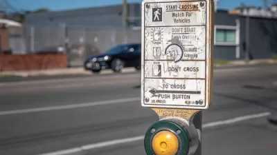
Branden Klayko makes a case study of Louisville, Kentucky to explore how the city's development patterns contribute to its traffic safety.
On that latter count, Klayko notes that Louisville is below the national average on pedestrian safety: "The city’s pedestrian death rate is above the national average—last year alone, 18 pedestrians died on Louisville streets and another 483 were struck by motorists. The numbers speak for themselves."
To expand the study, Klayko inserted Louisville's traffic fatality rate per 100,000 people into the findings of the "Cities Safer By Design" [pdf] report released by the World Resources Institute earlier this summer. According to Klayko, "It’s not a pretty picture. Louisville ranks worse than sprawling Atlanta in traffic fatality rate. Nearly twice as many are killed in Louisville per 100,000 residents than in Chicago, three times more than New York City, and quadruple the number as in Washington, D.C."
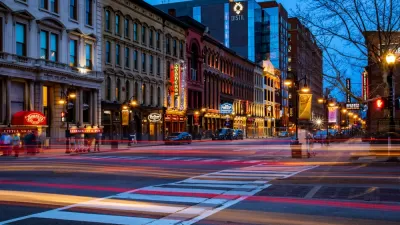
Reaching farther afield for comparison, "Louisville’s safety numbers fall in line with cities like Montevideo, Uruguay; Accra, Ghana; and Kolkata or Delhi, India. We’re significantly more dangerous than places like Jakarta, Indonesia; Beijing or Shanghai, China; and Mumbai, India." Meanwhile, "leaders in traffic safety—places like Stockholm, Sweden; Tokyo, Japan; and Berlin, Germany—experience a mere fraction of the death and injury on their streets as we do at home."
Klayko goes on to address each of the recommendations of the report for how to redesign streets to improve traffic safety, in some cases comparing those recommendations to the current conditions in Louisville.
FULL STORY: Report shows how Louisville’s traffic fatality rate is tied to building sprawl

Report: Racial Gap in Traffic Deaths Persists
Communities of color have significantly higher rates of traffic fatalities, according to federal research.
Louisville Slowly Working Toward Vision Zero Commitment
If approved, an ordinance under consideration in Louisville would commit to eventually eliminate traffic fatalities…20 years in the future.

Acceptable Deaths
What can we learn from our Covid response?

Maui's Vacation Rental Debate Turns Ugly
Verbal attacks, misinformation campaigns and fistfights plague a high-stakes debate to convert thousands of vacation rentals into long-term housing.

Planetizen Federal Action Tracker
A weekly monitor of how Trump’s orders and actions are impacting planners and planning in America.

In Urban Planning, AI Prompting Could be the New Design Thinking
Creativity has long been key to great urban design. What if we see AI as our new creative partner?

King County Supportive Housing Program Offers Hope for Unhoused Residents
The county is taking a ‘Housing First’ approach that prioritizes getting people into housing, then offering wraparound supportive services.

Researchers Use AI to Get Clearer Picture of US Housing
Analysts are using artificial intelligence to supercharge their research by allowing them to comb through data faster. Though these AI tools can be error prone, they save time and housing researchers are optimistic about the future.

Making Shared Micromobility More Inclusive
Cities and shared mobility system operators can do more to include people with disabilities in planning and operations, per a new report.
Urban Design for Planners 1: Software Tools
This six-course series explores essential urban design concepts using open source software and equips planners with the tools they need to participate fully in the urban design process.
Planning for Universal Design
Learn the tools for implementing Universal Design in planning regulations.
planning NEXT
Appalachian Highlands Housing Partners
Mpact (founded as Rail~Volution)
City of Camden Redevelopment Agency
City of Astoria
City of Portland
City of Laramie