


Open data can be a powerful tool for illustrating the risks to public safety that will have to be overcome as more cities adopt Vision Zero initiatives.
"Montgomery County now publishes detailed traffic violation data, which goes online daily here," according to a post by Jacob Mason. "This data allows anyone to see where and when the police are issuing citations, and to whom." Mason used that data, for instance, to create a map of speeding violations covering June 1 through August 16. On the map, the size of the bubbles representing violations even correspond to how far over the speed limit the driver was traveling when cited.
With the map as an illustration, Mason argues for more and better open data projects by local governments. Mason pays specific attention to the Washington, D.C.'s region, which he says had made progress but can still improve.
FULL STORY: When governments make road data public, anyone can help make roads safer


Let’s End Traffic Stops
The technology to make traffic enforcement obsolete is becoming available. But in the U.S. willing to use it?
When it Comes to Road Diets, Evidence Doesn't Matter
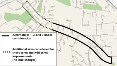
Drivers are a powerful enough lobby to overcome all evidence of the need to redesign streets for safety. Examples from Maryland and Virginia provide the latest case studies in Vision Zero futility.
Speeding Camera Issues 6,000 Tickets in a Day—Is it Unfair?
After issuing 6,000 speeding tickets in one day, a speeding camera in Sheepshead Bay in New York City has already influenced driving habits. But some in the community are calling the location of the cameras a trap.

Planetizen Federal Action Tracker
A weekly monitor of how Trump’s orders and actions are impacting planners and planning in America.

Maui's Vacation Rental Debate Turns Ugly
Verbal attacks, misinformation campaigns and fistfights plague a high-stakes debate to convert thousands of vacation rentals into long-term housing.

San Francisco Suspends Traffic Calming Amidst Record Deaths
Citing “a challenging fiscal landscape,” the city will cease the program on the heels of 42 traffic deaths, including 24 pedestrians.

Defunct Pittsburgh Power Plant to Become Residential Tower
A decommissioned steam heat plant will be redeveloped into almost 100 affordable housing units.

Trump Prompts Restructuring of Transportation Research Board in “Unprecedented Overreach”
The TRB has eliminated more than half of its committees including those focused on climate, equity, and cities.

Amtrak Rolls Out New Orleans to Alabama “Mardi Gras” Train
The new service will operate morning and evening departures between Mobile and New Orleans.
Urban Design for Planners 1: Software Tools
This six-course series explores essential urban design concepts using open source software and equips planners with the tools they need to participate fully in the urban design process.
Planning for Universal Design
Learn the tools for implementing Universal Design in planning regulations.
Heyer Gruel & Associates PA
JM Goldson LLC
Custer County Colorado
City of Camden Redevelopment Agency
City of Astoria
Transportation Research & Education Center (TREC) at Portland State University
Jefferson Parish Government
Camden Redevelopment Agency
City of Claremont