


24/7 Wall Street created an index to measure the most racially segregated cities in the United States.
Alexander Kent and Thomas C. Frolich summarize the narrative behind a recent post: "Large metropolitan areas are among the nation’s most segregated regions, and while none are meaningfully integrated, some are divided far more along racial lines than others."
Writing for 24/7 Wall Street, the two authors set out to identify the most segregated neighborhoods in the United States. To do so, they "constructed an index based on the share of a metro area’s population living in racially homogeneous zip codes — areas where more than 80% of the population is of a single race or ethnicity. In metro areas with complete integration, every zip code has the same racial/ethnic distribution as the area’s whole population. In areas with the worst segregation, no one lives in a zip code with anyone of a different race/ethnicity."
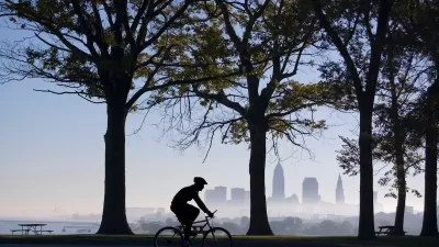
The index producesCleveland-Elyria, OH as the most segregated city in the United States, with"more than 55% of its population living in homogeneous zip codes." Moreover, "[o]f the roughly 100 zip codes in the area, 63 are predominantly white and are home to nearly 70% of Cleveland’s white population. The metro area’s black population is similarly segregated, with 30.9% concentrated in just six zip codes."Detroit-Warren-Dearborn, MI took the second spot on the list.
FULL STORY: America’s Most Segregated Cities

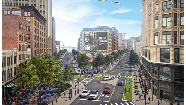
Downtown Cleveland Gets First Ever Protected Bike Lanes
The $200,000 “quick build” lanes are the first of 50 planned miles over five years.
Cleveland To Build First Protected Downtown Bike Lane
The city is taking steps to build out a more comprehensive bike lane network to connect downtown destinations.
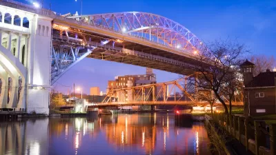
Defunct Streetcar Bridge Could Become Cleveland’s ‘Low Line’
The city will develop a plan to transform an unused streetcar deck on the Veterans Memorial Bridge into a connector for bikes and pedestrians as well as a welcoming public space.

Planetizen Federal Action Tracker
A weekly monitor of how Trump’s orders and actions are impacting planners and planning in America.

The Simple Legislative Tool Transforming Vacant Downtowns
In California, Michigan and Georgia, an easy win is bringing dollars — and delight — back to city centers.

San Francisco's School District Spent $105M To Build Affordable Housing for Teachers — And That's Just the Beginning
SFUSD joins a growing list of school districts using their land holdings to address housing affordability challenges faced by their own employees.

In More Metros Than You’d Think, Suburbs are Now More Expensive Than the City
If you're moving to the burbs to save on square footage, data shows you should think again.

The States Losing Rural Delivery Rooms at an Alarming Pace
In some states, as few as 9% of rural hospitals still deliver babies. As a result, rising pre-term births, no adequate pre-term care and "harrowing" close calls are a growing reality.

The Small South Asian Republic Going all in on EVs
Thanks to one simple policy change less than five years ago, 65% of new cars in this Himalayan country are now electric.
Urban Design for Planners 1: Software Tools
This six-course series explores essential urban design concepts using open source software and equips planners with the tools they need to participate fully in the urban design process.
Planning for Universal Design
Learn the tools for implementing Universal Design in planning regulations.
Smith Gee Studio
City of Charlotte
City of Camden Redevelopment Agency
City of Astoria
Transportation Research & Education Center (TREC) at Portland State University
US High Speed Rail Association
City of Camden Redevelopment Agency
Municipality of Princeton (NJ)