


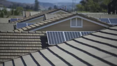
Currently in its early stages, Project Sunroof tracks how much sun every roof receives. Then it estimates the costs and savings if rooftop solar were installed. Right now, the tool only covers the Bay Area, Fresno, and Boston.

Google wants to make it easier for homeowners to think about going solar. A new map-based tool, Project Sunroof, lets users check whether their home (or any other structure within the coverage area) gets enough sunlight to warrant solar installation. Then it estimates costs and savings. In its current stage, the tool only covers the Bay Area, Fresno, and Boston.
Once you look up an address, "you can fine-tune the estimate to figure out whether solar panels on your roof make financial sense, by plugging in your monthly electric bill, choosing a financing option (leasing versus loans versus buying), and so forth."
Project Sunroof's estimates take local circumstances into account. "California, for instance, has high electricity prices, which means there are bigger potential savings from installing rooftop solar. The tool also factors in various regional policy incentives — like state tax incentives, local rebates, and what kind of net metering rules a state has [...]"
The article discusses how residents of multi-family dwellings can take advantage of community solar. "These are programs in which people who don't own suitable roofs can agree to 'subscribe' to electricity from a solar PV project elsewhere. They then pay a monthly charge that appears on their utility bill."
FULL STORY: Are solar panels right for you? Google's new mapping tool can help you decide

Mapping Rooftop Solar to Make It a Social Norm
Debuted in 2015, Google's Project Sunroof is designed make it easier for homeowners to go solar. Now the tool is harnessing peer pressure to "create a social norm" around solar.
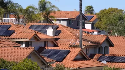
California Leads in Solar Rooftops
A combination of state and local incentives and building code mandates has helped California far outpace other states in residential rooftop solar permits.
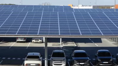
Commercial Buildings, Parking Lots Offer Significant Potential for Solar Energy
Massive swaths of flat rooftops, garages, and surface parking lots go underutilized. They could be producing renewable energy.

Maui's Vacation Rental Debate Turns Ugly
Verbal attacks, misinformation campaigns and fistfights plague a high-stakes debate to convert thousands of vacation rentals into long-term housing.

Planetizen Federal Action Tracker
A weekly monitor of how Trump’s orders and actions are impacting planners and planning in America.

In Urban Planning, AI Prompting Could be the New Design Thinking
Creativity has long been key to great urban design. What if we see AI as our new creative partner?

King County Supportive Housing Program Offers Hope for Unhoused Residents
The county is taking a ‘Housing First’ approach that prioritizes getting people into housing, then offering wraparound supportive services.

Researchers Use AI to Get Clearer Picture of US Housing
Analysts are using artificial intelligence to supercharge their research by allowing them to comb through data faster. Though these AI tools can be error prone, they save time and housing researchers are optimistic about the future.

Making Shared Micromobility More Inclusive
Cities and shared mobility system operators can do more to include people with disabilities in planning and operations, per a new report.
Urban Design for Planners 1: Software Tools
This six-course series explores essential urban design concepts using open source software and equips planners with the tools they need to participate fully in the urban design process.
Planning for Universal Design
Learn the tools for implementing Universal Design in planning regulations.
planning NEXT
Appalachian Highlands Housing Partners
Mpact (founded as Rail~Volution)
City of Camden Redevelopment Agency
City of Astoria
City of Portland
City of Laramie