


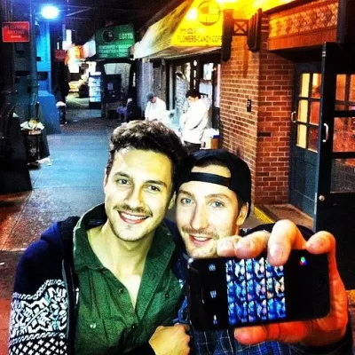
Researchers who studied the appeal of New York City streetscapes find an additionally significant factor on the streets of Salt Lake City: the photo op.
A recent study by planning scholar Reid Ewing determined that three streetscape features significantly correlate to pedestrian use in NYC: active use (i.e., streets with schools, busy office buildings and parks); the presence of street furniture (such as ATMs, parking meters, and benches); and first-floor window-to-façade ratio (the proportion of windows on a building’s façade). But New York City is not called the Greatest City on Earth for nothing. As Laura Bliss writes, "There’s so much that sets New York apart from other American cities: its density, its walkability, its spread of urban versus suburban development, among others. What about smaller towns?"
Ewing’s new study of Salt Lake City suggests that to achieve walkability, planners in other cities might want to also ask: can it be Instagrammed?
The Salt Lake City study was designed to determine whether pedestrians in a less dense city with an average level of metropolitan sprawl were drawn to streetscapes with the same features found to be significant in NYC. While two of the three factors—active use and windows—contributed to the significance of what the researchers termed transparency on 179 blocks in Salt Lake City, of additional importance was the imageability of a streetscape.
Imageability, Bliss writes, "is what makes a place distinctive and memorable—a visual identity that could be made of parks or plazas, unique views or vistas, old or unusual architecture, and al fresco dining."
The relative importance of imageability is still widely unknown. However, reports last winter of young girls taking selfies in front of an active building explosion site in NYC’s East Village suggest that, as Bliss reports, "walkability is about more than density, street-level retail, or any one design quality in isolation."
FULL STORY: How Urban Designers Can Get Smaller Cities Walking


Meet NYC’s New Office of Livable Streets
The NYC DOT program will build on pandemic-era initiatives to promote safe and comfortable streets that enhance community and expand uses beyond just moving cars.
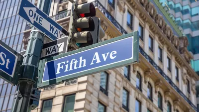
What Will Become of Fifth Avenue?
Visitors to the iconic shopping street overwhelmingly arrive by walking, transit, or bike. Why are bike and pedestrian infrastructure improvement lagging so far behind another famous NYC street, Broadway?
‘Instagrammed to Death’ or a Return to Pre-Pandemic Normal?
Familiar controversies might seem reassuring in 2022.

Planetizen Federal Action Tracker
A weekly monitor of how Trump’s orders and actions are impacting planners and planning in America.

Congressman Proposes Bill to Rename DC Metro “Trump Train”
The Make Autorail Great Again Act would withhold federal funding to the system until the Washington Metropolitan Area Transit Authority (WMATA), rebrands as the Washington Metropolitan Authority for Greater Access (WMAGA).

DARTSpace Platform Streamlines Dallas TOD Application Process
The Dallas transit agency hopes a shorter permitting timeline will boost transit-oriented development around rail stations.

Renters Now Outnumber Homeowners in Over 200 US Suburbs
High housing costs in city centers and the new-found flexibility offered by remote work are pushing more renters to suburban areas.

The Tiny, Adorable $7,000 Car Turning Japan Onto EVs
The single seat Mibot charges from a regular plug as quickly as an iPad, and is about half the price of an average EV.

Supreme Court Ruling in Pipeline Case Guts Federal Environmental Law
The decision limits the scope of a federal law that mandates extensive environmental impact reviews of energy, infrastructure, and transportation projects.
Urban Design for Planners 1: Software Tools
This six-course series explores essential urban design concepts using open source software and equips planners with the tools they need to participate fully in the urban design process.
Planning for Universal Design
Learn the tools for implementing Universal Design in planning regulations.
Municipality of Princeton
Roanoke Valley-Alleghany Regional Commission
City of Mt Shasta
City of Camden Redevelopment Agency
City of Astoria
Transportation Research & Education Center (TREC) at Portland State University
US High Speed Rail Association
City of Camden Redevelopment Agency
Municipality of Princeton (NJ)