


Josh Whitehead, planning director of the Memphis and Shelby County Office of Planning & Development (OPD), discusses competing with suburbs, implementing a new zoning code, and redeveloping, for a second time, historic streetcar corridors.
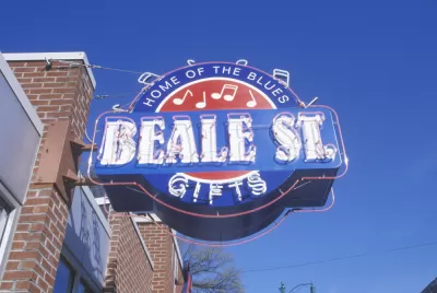
The most famous house in Memphis is, for all its charms, the epitome of sprawl. Its former resident is more famous than most cities, and its most famous street, Beale Street, is only a few blocks long. Beyond those icons is a workaday city of 650,000—spread out over 324 square miles. With one edge of downtown bounded in by the Mississippi River and, until recently, freedom to grow to the east and north, Memphis has not pursued downtown revitalization the way that other cities have. Memphis instead is working to increase density throughout the city and make its major streets seem less like the mini-expressways that they are today.
Guiding these efforts is Josh Whitehead, an attorney and semi-native Memphian, by way of Dallas and Cincinnati, who was appointed in 2010 to be planning director/administrator of the Memphis and Shelby County Office of Planning & Development (OPD). Whitehead spoke with Contributing Editor Josh Stephens for the Planetizen "Planners Across America" series.
How did you go from law to planning?
After undergrad I moved to Cincinnati for the Design, Architecture, Art, and Planning program [at the University of Cincinnati]. After planning school I did a stint with AmeriCorps in Cincinnati. My assignment was to work with a civic group called Citizens for Civic Renewal.
Our main project was to work on regional collaboration. Metro Cincinnati is very fragmented. It was great, and we got a lot of dialog created and eventually there were some quick, albeit minor, wins from that. Through that process I thought maybe having a legal background would be a better way to effectuate some of the changes. I went to law school and came back home to Memphis.
How is Memphis changing?
As any person remotely close to planning knows, center cities have been and will continue be at a somewhat competitive disadvantage compared to some of their suburbs. Obviously inner-ring suburbs have their own challenges. Tennessee, up until last year, was one of the last annexation-by-ordinance states, versus annexation by referendum. The legislative body of the city holds the cards and annexes by will. Because we were an elastic city, we were always able to grow and capture a lot of our suburban growth.
It wasn't until last year that we started asking, "what if we had fixed boundaries?" We're in a tri-state region, so we weren't able to capture all of our suburban growth. Now today, we truly have to think about competing with our suburbs. Our county is now adept at providing urban services and a lot of property owners see less of an advantage to being annexed. Number one is to show the marketplace that we are open for business and we are willing to be proactively business-friendly.
At the same time, with our new zoning code, which is about four years old, we do expect a higher degree of design, landscaping, etc. In the code it replaced, if you were zoned industrial, we really didn't expect you to do any kind of landscaping. We also had an exemption: if you had a four-acre lot…you were exempt from many kinds of review. Now we've said we don't care if you're in an exempt tract. Any new buildings or expansions have to through some kind of site plan review. I think we are trying to demonstrate that by raising the bar and expecting a better product, maybe investors are more willing to invest.
Now that the city's boundaries are essentially set, are you focusing on suburban areas or on the central business district?
Yes and yes. Living in Cincinnati, I think their last annexation was 1917 or something like that. They are the core—they're something like 81 square miles. Memphis is 340.
This is the first time we've said, "here are our fixed boundaries, let's focus on our existing area." Downtown Memphis has historically had challenges because of the Mississippi River. Across the river, we have this floodplain. No development can occur on the Arkansas side for about ten miles, so we have almost exclusively grown east.
Our downtown is not at all centralized to the metro. As people have moved out to the suburbs farther and farther out, our "central" business district is like an edge city developed in the mid-1970s and continues to be robust. The good news is, it's in our city limits. The bad news is, it's probably about 20 miles east of "downtown."
Our Downtown Commission is funded by a tax assessment/BID. Much to their credit, downtown has become less of an office downtown and office center than a residential center. We now have something like 50,000 people downtown. A lot of that includes Harbortown, which is a New Urbanist development on a former soybean field. We have an old railyard that is another New Urbanist development. In between are a lot of former office towers from the first decades of the 20th century that have gone residential.
In the last five years, that has bled into what we call Midtown. Our midtown has recently experienced densification. I think it's just the greater appreciation of living in a pedestrian environment.
What innovations will the new plan include?
Some of our older areas have a greater potential of becoming more pedestrian-oriented. We find in our overlays, there's this chicken-and-egg situation: we have streets that are historically streetcar streets. Some of these streets, right or wrong, were redeveloped in the '40s, '50s and '60s with a very highway, commercial format.
We embraced the automobile pretty early. We were one of the first major cities to remove our streetcar lines and go rubber with our buses. We are trying to create something that never was. The developer says, "this is a six-lane state highway….it was developed in the '50s, and you’re expecting me to cater to pedestrian clientele that doesn't really exist." We say, "well, it won't exist if we don’t have more buildings." They say, "that's fine, but, do I have to be the first one?"
Over time, maybe we can push the envelope a little more because there will be more buildings and, hopefully, more pedestrians. That six-lane road, there's a plan in the city engineer's office to turn it into a five-lane street with bike lanes. It’s hard to get builders to build up to the sidewalk if the city isn’t going to do its part with on-street parking.
All these big roads made sense in the 1950s. Now the population has de-concentrated so much, those big roads don't have half the traffic they did in 1950. We have these roads that are just too big. So notwithstanding whatever nebulous planning argument that should be made, we don't have to make them. We can justifiably go to these lane diets.
What's it like to plan the city in which you grew up?
When I was young, in 1980, like a lot of southerners moved to the "it" city at the time: Dallas. We didn't actually live in Dallas; we lived in Plano. It is the mother of all suburbs. I think that really influenced my outlook on everything.
I gained an appreciation for Memphis' authenticity. Being in Dallas, nobody in Dallas is "from" Dallas. Among my friends, we all were so proud of our hometowns, for some reason. We'd go back to Memphis for holidays to see my grandparents. Memphis was my foray into urban design and historic buildings. For a southern city, it does have a pretty good stock from that era.
Fast-forward: Throughout the last 15 years, I probably applied to OPD four or five times and, for whatever reason, I never got a job. I was under-qualified, overqualified, who knows.
I didn't necessarily ever dream about heading this department. I just wanted to work at this department. As things happen, I took the bar exam, and a few months later a friend who was the assistant city attorney assigned to OPD got another job. To soften the news to his supervisors, he found a candidate with a planning background and a law license to fill his place. That's how I got here.
I started out five years ago as an assistant city attorney assigned to the department. When the position of planning director came up six months ago, I applied and was appointed. It was a strange way into a department that I had over a 15-year period wanted to be involved with.
Who or what has influenced your approach to planning?
The summer before I started grad school, I lived on Ludlow Avenue in Cincinnati—a couple of blocks that haven’t changed since probably 1880. It's a pedestrian's dream. Living on that street had an effect on me.
I remember reading The Geography of Nowhere and learning the fact that zoning codes had destroyed Saratoga Springs. I thought, "this can’t be. This is so stupid." Then of course before I read Cities Without Suburbs, David Rusk's edict that elastic cities are healthier than inelastic cities. Although I'm second-guessing that theory. There are a lot of inelastic cities that are doing very well, thank you very much. I've kind of backed away on the influence that book has had on me.
These days most of my planning information comes from websites like yours and the APA.
This interview has been edited and condensed.


Pursuing Inclusion, Equity in the Nation's Capital
The history of Washington, D.C., both recent and distant, has generated one of the most fascinating planning case studies in the country. The man leading the D.C. Office of Planning explains his approach the unique responsibilities of the job.
Memphis Wants To Shrink
After decades of sprawl, Memphis begins to reconsider its growth pattern and chart a new course towards fiscal sustainability.

Planners Across America: Raleigh Makes Room to Grow Under the Leadership of Ken Bowers
In this interview for the "Planners Across America" series, Ken Bowers, AICP, discusses how the city of Raleigh will rely on the city's new comprehensive plan and development code to accommodate 100,000 new residents by 2030.

Planetizen Federal Action Tracker
A weekly monitor of how Trump’s orders and actions are impacting planners and planning in America.

Maui's Vacation Rental Debate Turns Ugly
Verbal attacks, misinformation campaigns and fistfights plague a high-stakes debate to convert thousands of vacation rentals into long-term housing.

Restaurant Patios Were a Pandemic Win — Why Were They so Hard to Keep?
Social distancing requirements and changes in travel patterns prompted cities to pilot new uses for street and sidewalk space. Then it got complicated.

In California Battle of Housing vs. Environment, Housing Just Won
A new state law significantly limits the power of CEQA, an environmental review law that served as a powerful tool for blocking new development.

Boulder Eliminates Parking Minimums Citywide
Officials estimate the cost of building a single underground parking space at up to $100,000.

Orange County, Florida Adopts Largest US “Sprawl Repair” Code
The ‘Orange Code’ seeks to rectify decades of sprawl-inducing, car-oriented development.
Urban Design for Planners 1: Software Tools
This six-course series explores essential urban design concepts using open source software and equips planners with the tools they need to participate fully in the urban design process.
Planning for Universal Design
Learn the tools for implementing Universal Design in planning regulations.
Heyer Gruel & Associates PA
JM Goldson LLC
Custer County Colorado
City of Camden Redevelopment Agency
City of Astoria
Transportation Research & Education Center (TREC) at Portland State University
Jefferson Parish Government
Camden Redevelopment Agency
City of Claremont