


It's an early idea, but Pittsburgh, with support from transportation planners and the Pittsburgh Downtown Partnership, could be the next U.S. city to consider the shared streets concept.
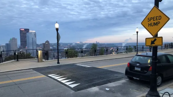
A group of local stakeholders are pitching a shared streets concept for Downtown Pittsburgh for the section of Liberty Avenue from Commonwealth Place to Stanwix Street, reports Jon Schmitz.
According to Schmitz, the idea "emerged from a seminar hosted by the Pittsburgh Downtown Partnership and AARP, and guided by the Walkable and Livable Communities Institute, a nonprofit organization based in Washington state. The seminar is part of Envision Downtown, a program announced this year by Mayor Bill Peduto to promote sustainable development."
The concept of shared streets has been more common in Europe but is picking up momentum in the United States. Chicago, for instance, has shared streets plans on the way, with a project potentially due next year.
As for Pittsburgh's early ideas, the seminar visited the intersection of Liberty, Stanwix, Forbes Avenue and Penn Avenue and found a dysfunctional intersection, with long wait times and many users already employing the shared streets concept by crossing against the light. The group's recommendations include some less revolutionary ideas to improve safety along the corridor as well, including bulb outs, new landscaping, and bike lanes.
FULL STORY: Is a transportation free-for-all coming to Pittsburgh’s Golden Triangle?

Pittsburgh Launches $32 Million 'Envision Downtown' Initiative
The Envision Downtown Initiative will focus on street improvements to improve public interactions.
Pittsburgh Excels at Low-Cost, Quick-Build Traffic Calming
The city’s traffic calming initiative has led to a 6 percent average reduction in speeds on corridors with recent interventions.

Pittsburgh Agencies Collaborate on Vision Zero Projects
The city reduced pedestrian deaths to seven in 2023.

Maui's Vacation Rental Debate Turns Ugly
Verbal attacks, misinformation campaigns and fistfights plague a high-stakes debate to convert thousands of vacation rentals into long-term housing.

Planetizen Federal Action Tracker
A weekly monitor of how Trump’s orders and actions are impacting planners and planning in America.

In Urban Planning, AI Prompting Could be the New Design Thinking
Creativity has long been key to great urban design. What if we see AI as our new creative partner?

King County Supportive Housing Program Offers Hope for Unhoused Residents
The county is taking a ‘Housing First’ approach that prioritizes getting people into housing, then offering wraparound supportive services.

Researchers Use AI to Get Clearer Picture of US Housing
Analysts are using artificial intelligence to supercharge their research by allowing them to comb through data faster. Though these AI tools can be error prone, they save time and housing researchers are optimistic about the future.

Making Shared Micromobility More Inclusive
Cities and shared mobility system operators can do more to include people with disabilities in planning and operations, per a new report.
Urban Design for Planners 1: Software Tools
This six-course series explores essential urban design concepts using open source software and equips planners with the tools they need to participate fully in the urban design process.
Planning for Universal Design
Learn the tools for implementing Universal Design in planning regulations.
planning NEXT
Appalachian Highlands Housing Partners
Mpact (founded as Rail~Volution)
City of Camden Redevelopment Agency
City of Astoria
City of Portland
City of Laramie