


The Safer Market Street project is one of a package of traffic safety projects underway in San Francisco to achieve a Vision Zero goal to eliminate traffic deaths by 2024.
"The push to divert private cars off of congested central Market Street will accelerate in August when drivers traveling between Eighth and Third streets will no longer be able to turn onto the main thoroughfare," reports J.K. Dineen.
The decision comes from the San Francisco Municipal Transportation Agency (SFMTA) Board of Directors, which has set a goal for Vision Zero to eliminate pedestrian deaths.
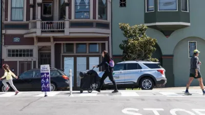
According to Dineen, the stretch of Market Street impacted by the decision "is a noisy, teeming river of pedestrians, bikes, buses, trolleys, taxis, trucks and skateboarders. While it makes for a lively and entertaining urban boulevard, it is also dangerous — it contains four of the city’s top 20 intersections for pedestrian injury collisions and the top two intersections for bicycle injury collisions."
The change will reduce traffic on the street by 30 to 50 percent, which will, according to the SFMTA, reduce the probability of collisions, fatalities, and injuries. The article also notes that opposition to the proposal was limited while quoting words of support from representatives of WalkSF and the SFMTA's Sustainable Streets Division.
FULL STORY: In safety move, turns onto Market Street to be limited


Uber Vehicles are Not Taxis, Even When They Want To Be
A June 16 vote by the San Francisco MTA to improve safety will allow taxis, along with bicycles and Muni buses, but not ride-hailing services to make turns onto the downtown's main thoroughfare, Market Street, has upset San Francisco-based Uber.
San Francisco Slow Streets Bucks Citywide Trend, Reducing Injuries by 61 Percent
Low-cost interventions aimed at slowing traffic are making a major impact on road safety.
San Francisco Implements ‘Daylighting’ at Intersections
Vehicles are prohibited from parking within 20 feet of a crosswalk as part of the city’s Vision Zero efforts to eliminate traffic deaths and make roads safer.

Maui's Vacation Rental Debate Turns Ugly
Verbal attacks, misinformation campaigns and fistfights plague a high-stakes debate to convert thousands of vacation rentals into long-term housing.

Planetizen Federal Action Tracker
A weekly monitor of how Trump’s orders and actions are impacting planners and planning in America.

In Urban Planning, AI Prompting Could be the New Design Thinking
Creativity has long been key to great urban design. What if we see AI as our new creative partner?

King County Supportive Housing Program Offers Hope for Unhoused Residents
The county is taking a ‘Housing First’ approach that prioritizes getting people into housing, then offering wraparound supportive services.

Researchers Use AI to Get Clearer Picture of US Housing
Analysts are using artificial intelligence to supercharge their research by allowing them to comb through data faster. Though these AI tools can be error prone, they save time and housing researchers are optimistic about the future.

Making Shared Micromobility More Inclusive
Cities and shared mobility system operators can do more to include people with disabilities in planning and operations, per a new report.
Urban Design for Planners 1: Software Tools
This six-course series explores essential urban design concepts using open source software and equips planners with the tools they need to participate fully in the urban design process.
Planning for Universal Design
Learn the tools for implementing Universal Design in planning regulations.
planning NEXT
Appalachian Highlands Housing Partners
Mpact (founded as Rail~Volution)
City of Camden Redevelopment Agency
City of Astoria
City of Portland
City of Laramie