


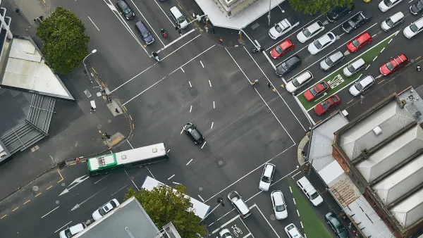
An editorial explains that the fear inspired by shared streets—the idea that pedestrians, bikes, and cars have equal claim to navigate the street without the regulatory layer implemented by traffic engineers—is exactly why they work.
Jonathan Coppage responds to the criticism of an earlier article describing the shared street concept:
For some reason this is the objection that immediately emerges everywhere the idea of shared space is raised: the British think ‘that may work for those upstanding Dutch, but not for us,’ Americans think ‘that may work for those nice Brits, but not us.’ Even in-country, you will often hear, ‘that may work in a small town, but not Jersey,’ ‘not Boston,’ ‘not where I’m from, have you seen these crazy people?’
But, according to Coppage, the fear expressed by critics of the shared street concept is exactly why the idea works:
Hans Monderman, the father of the shared space movement, made his name with the 2001 redesign of the Dutch town of Drachten’s town square. A town of 45,000, Monderman saw accidents fall from eight annually to one, yet was pleased to hear “that residents, despite the measurable increase in safety, perceived the place to be more dangerous. This was music to Monderman’s ears. If they had not felt less secure, he said, he ‘would have changed it immediately.’”
Coppage notes that the experiment is also about to have its moment stateside, with a new project in Chicago joining existing shared streets in Seattle and Buffalo.
FULL STORY: Why Shared Space Scares


Let’s End Traffic Stops
The technology to make traffic enforcement obsolete is becoming available. But in the U.S. willing to use it?
How Understanding Near-Misses Can Improve Road Safety
Most road safety efforts are based on data about crashes that have already occurred. But important information can be gleaned from incidents when something almost went wrong, but didn’t.

Vehicle-related Deaths Drop 29% in Richmond, VA
The seventh year of the city's Vision Zero strategy also cut the number of people killed in alcohol-related crashes by half.

Planetizen Federal Action Tracker
A weekly monitor of how Trump’s orders and actions are impacting planners and planning in America.

Maui's Vacation Rental Debate Turns Ugly
Verbal attacks, misinformation campaigns and fistfights plague a high-stakes debate to convert thousands of vacation rentals into long-term housing.

San Francisco Suspends Traffic Calming Amidst Record Deaths
Citing “a challenging fiscal landscape,” the city will cease the program on the heels of 42 traffic deaths, including 24 pedestrians.

Amtrak Rolls Out New Orleans to Alabama “Mardi Gras” Train
The new service will operate morning and evening departures between Mobile and New Orleans.

The Subversive Car-Free Guide to Trump's Great American Road Trip
Car-free ways to access Chicagoland’s best tourist attractions.

San Antonio and Austin are Fusing Into one Massive Megaregion
The region spanning the two central Texas cities is growing fast, posing challenges for local infrastructure and water supplies.
Urban Design for Planners 1: Software Tools
This six-course series explores essential urban design concepts using open source software and equips planners with the tools they need to participate fully in the urban design process.
Planning for Universal Design
Learn the tools for implementing Universal Design in planning regulations.
Heyer Gruel & Associates PA
JM Goldson LLC
Custer County Colorado
City of Camden Redevelopment Agency
City of Astoria
Transportation Research & Education Center (TREC) at Portland State University
Jefferson Parish Government
Camden Redevelopment Agency
City of Claremont