


An article by Ben Campkin, Marina Mogilevich, and Rebecca Ross examines how images shape ideas about cities—from "John Snow’s Cholera map to Le Corbusier's plan for a contemporary city and Moose's 'clean graffiti.'"
"Maps, plans, photographs, renders, computer generated images, street art and signage drive physical changes and are central to perceptions of place and claims to territory," write the trio of researchers for Guardian Cities.
"When we make things visible, we make them public and subject to debate. Urban images not only offer insights to help analyse and understand cities, but also point to ways of radically altering their futures."
In addition to the examples cited above, the article also mentions the photojournalism of Jacob Riis and the exhibition sat the Shanghai Urban Panning and Exhibition Centre. The article also introduces the Picturing Place project, hosted by the University College London. The first of the Picturing Place series on Guardian Cities focuses on the iconic images of Brasilia—capital city of Brazil.
FULL STORY: How images shape our cities

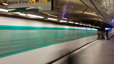
An Animation of the World's Transit Systems
"A German university student has developed a fun new tool for visualizing public transit in a more system-oriented way," according to a post by Sam Sturgis.
Visualizing the Spread of the OpenStreetMap Project
OpenStreetMap has released an animated map to illustrate the impressive growth of the project over the first ten years of its existence.

40 Visualizations of America and its Relationship with Food
A new post by Vox includes 40 maps, charts, and graphs explain that where and how food works in America.

Planetizen Federal Action Tracker
A weekly monitor of how Trump’s orders and actions are impacting planners and planning in America.

Restaurant Patios Were a Pandemic Win — Why Were They so Hard to Keep?
Social distancing requirements and changes in travel patterns prompted cities to pilot new uses for street and sidewalk space. Then it got complicated.

Map: Where Senate Republicans Want to Sell Your Public Lands
For public land advocates, the Senate Republicans’ proposal to sell millions of acres of public land in the West is “the biggest fight of their careers.”

Maui's Vacation Rental Debate Turns Ugly
Verbal attacks, misinformation campaigns and fistfights plague a high-stakes debate to convert thousands of vacation rentals into long-term housing.

San Francisco Suspends Traffic Calming Amidst Record Deaths
Citing “a challenging fiscal landscape,” the city will cease the program on the heels of 42 traffic deaths, including 24 pedestrians.

California Homeless Arrests, Citations Spike After Ruling
An investigation reveals that anti-homeless actions increased up to 500% after Grants Pass v. Johnson — even in cities claiming no policy change.
Urban Design for Planners 1: Software Tools
This six-course series explores essential urban design concepts using open source software and equips planners with the tools they need to participate fully in the urban design process.
Planning for Universal Design
Learn the tools for implementing Universal Design in planning regulations.
Heyer Gruel & Associates PA
JM Goldson LLC
Custer County Colorado
City of Camden Redevelopment Agency
City of Astoria
Transportation Research & Education Center (TREC) at Portland State University
Camden Redevelopment Agency
City of Claremont
Municipality of Princeton (NJ)