


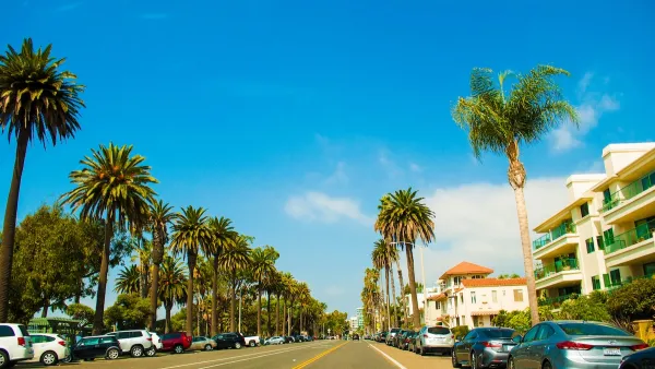
After noting the heated rhetoric that surrounds development in Santa Monica, especially during election season, Jason Islas reveals claims of the city's overdevelopment to be true—if we're talking about cars.

"Since 2003, Santa Monica saw a net increase of about about [sic] 230 new multi-family housing units a year. Considering that the regional population grew from about 9.7 million in 2003 to more than 10 million people in 2013, the rate of housing construction in Santa Monica is relatively low, especially considering the location’s desirability," reports Jason Islas.
Islas also reveals that commercial development has lagged behind the cap proposed by a failed 2008 anti-development initiative called Prop T, or the "Residents’ Initiative to Fight Traffic."
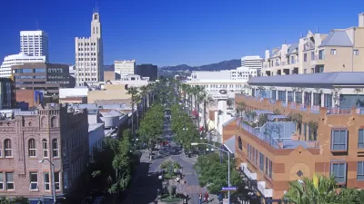
Planning is at least partly responsible for the city's development constraints: "Santa Monica’s award-winning Land Use and Circulation Element (LUCE) specifically prohibits increased density in about 96 percent of the city. The vast majority of the proposed development is slated to replace currently underdeveloped land either in the city’s downtown or the formerly industrial Bergamot Area, where the [defeated by NIMBYs] Transit Village project was proposed."
Santa Monica's ostensibly environmentalist and liberal residents have their true interests revealed by the kicker of the article: "Since 2003, according to City officials, 2,751,266 net new square feet of parking has been built in the city, for both commercial and multi-family residential projects. That’s 250,115 square feet of parking each year, or about 760 standard-sized (about 330 square feet, if you include space needed to maneuver your car) parking spaces."
FULL STORY: SANTA MONICA AND THE MYTH OF OVERDEVELOPMENT

Santa Monica May Raise Parking Permit Fees
The city says the changes would help better manage curb space and support its sustainability goals.
Parking Reform is Sweeping the Country. Does it Work?
A new study shows a significant reduction in housing construction costs in cities that have reduced or eliminated minimum parking requirements.
Santa Monica Garage-to-Affordable-Housing Conversion To Receive $2 Million
The city has been awarded $2 million in federal funding to support the conversion of a downtown parking structure into an affordable housing project.

Maui's Vacation Rental Debate Turns Ugly
Verbal attacks, misinformation campaigns and fistfights plague a high-stakes debate to convert thousands of vacation rentals into long-term housing.

Planetizen Federal Action Tracker
A weekly monitor of how Trump’s orders and actions are impacting planners and planning in America.

In Urban Planning, AI Prompting Could be the New Design Thinking
Creativity has long been key to great urban design. What if we see AI as our new creative partner?

Massachusetts Budget Helps Close MBTA Budget Gap
The budget signed by Gov. Maura Healey includes $470 million in MBTA funding for the next fiscal year.

Milwaukee Launches Vision Zero Plan
Seven years after the city signed its Complete Streets Policy, the city is doubling down on its efforts to eliminate traffic deaths.

Portland Raises Parking Fees to Pay for Street Maintenance
The city is struggling to bridge a massive budget gap at the Bureau of Transportation, which largely depleted its reserves during the Civd-19 pandemic.
Urban Design for Planners 1: Software Tools
This six-course series explores essential urban design concepts using open source software and equips planners with the tools they need to participate fully in the urban design process.
Planning for Universal Design
Learn the tools for implementing Universal Design in planning regulations.
Gallatin County Department of Planning & Community Development
Heyer Gruel & Associates PA
JM Goldson LLC
City of Camden Redevelopment Agency
City of Astoria
Transportation Research & Education Center (TREC) at Portland State University
Jefferson Parish Government
Camden Redevelopment Agency
City of Claremont