A recent study by the New York City Department of Transportation on buffered bike lane interventions showed maintained traffic speeds while cyclist safety increased.



One of the biggest barriers to implementing bike lanes in certain municipalities is their perception of slowing down car traffic. However, according to a recent study by the New York City Department of Transportation reported on by Eric Jaffe at CityLab, these urban interventions actually did not reduce car speeds, but maintained them while increasing cyclist safety.
One of the interventions studied was the 2008 and 2009 Eighth Avenue bike lanes, between 23rd and 34th streets. According to Jaffe, before the treatment, "the avenue carried four travel lanes, one parking lane, one parking-rush hybrid, and an unprotected bike lane. Again, by narrowing the lanes, all five were preserved (though the hybrid became a parking lane) even as riders gained additional protection."
With the protected bike lanes in place with a buffer, DOT measured a 14 percent overall reduction in daytime travel times along the corridor. Similar results were found along many other corridors where protected bike lanes were created.
A DOT spokesperson shared with CityLab that another street redesign was adding left-turn pockets, contributing to the maintained traffic speeds. According to the spokesperson, originally, "cars turned left from a general traffic lane; in the new one, they merged into a left-turn slot beside the protected bike lane. This design has two key advantages: first, traffic doesn't have to slow down until the left turn is complete, and second, drivers have an easier time seeing bike riders coming up beside them."
Read the full story: When Adding Bike Lanes Actually Reduces Traffic Delays

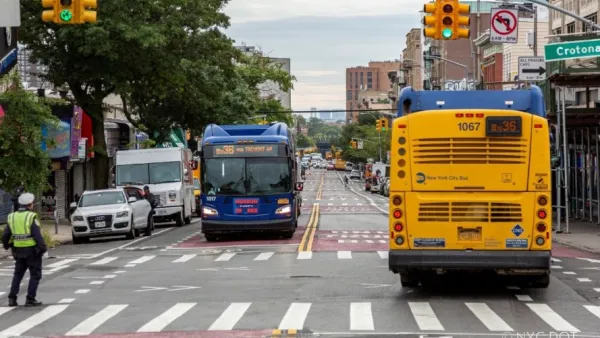
Buses travel at 5mph along this route in NYC. The Bronx's first-ever busway looks to change that
Prior to the busway, buses on the Bx36 route traveled as slowly as 5 miles per hour.
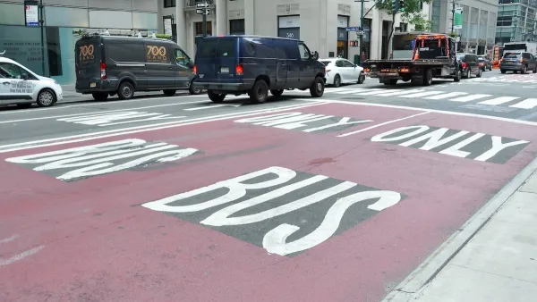
NYC DOT wants faster, more permanent street upgrades
The city is examining ways to build more concrete infrastructure without getting entangled in 'decades-long' projects.

Community feedback ushers in changes to NYC’s Park Avenue redesign
New aspects of the design include a two-way bike lane and separate paths for cyclists and pedestrians.

Planetizen Federal Action Tracker
A weekly monitor of how Trump’s orders and actions are impacting planners and planning in America.
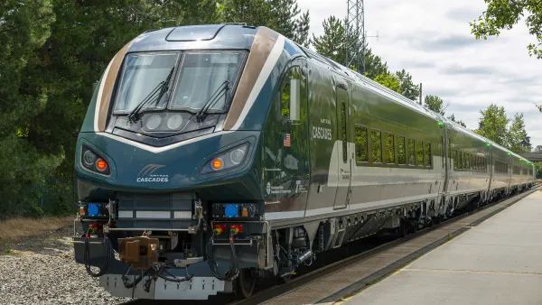
Northwest rail fans eager for Sept. 30 debut of Amtrak’s Airo fleet
Get ready for that new train smell and more seats. But they won’t go faster or run more frequently on the Cascades route in Washington and Oregon.

Trump is considering data centers on 6 states' public land — some state officials say they had no idea
If the administration approves the proposed projects, data center and data center-related developments will cover 17,600 acres of public land.

After decades of planning, Sacramento gains new light rail station
Trains will arrive every 15 minutes during peak hours and every 30 minutes during non-peak hours.

Massive tunnel-boring machine breaks ground on Gateway Project
The Trump administration revoked funding for the project in October 2025, and then restored it earlier this year.

Airo trainsets begin service on Amtrak Cascades route
The trains feature panoramic windows, complementary wifi and over 300 seats per train set.

FREE Course: Walkable City 1: Why Walkability?
After describing his path towards focusing on walkability as the essence of good planning, Jeff Speck marches through his five principal reasons for making more walkable places.
Reinventing Malls: Planning Alchemy—Turning Gray Fields Into Gold
The course focuses on the opportunities and imperatives that shape reinvention of mall sites.

City of Thousand Oaks
City of Wisconsin Rapids
Harvard University Graduate School of Design
The Architects Foundation
University of Cincinnati Online
Northern Illinois Transit Authority (NITA)
The Pocatello Development Authority
The Urban Renewal Agency of the City of Pocatello