A recently adopted ordinance allows developers to build significantly fewer parking spaces for projects in proximity to transit stations. Developers have already responded to the advantages offered by the reduced requirements.


According to Chris Bentley of Architect's Newspaper, an ordinance passed last fall in Chicago allows any residential developments within 600 feet of a transit station (or 1,200 on certain "Pedestrian Streets") to slash its parking requirements by 50 percent.
The first project taking advantage of this broke ground in July. As Bentley writes, "[t]he building will have 40 apartments... 2,500 square feet of commercial space, and 21 parking spaces—roughly half the amount of parking it would have been required to supply otherwise. 'Not having to put all these cars in there,' said firm principal David Brininstool, 'this is such a win-win for the city, the streetscape, and the developer.'"
Many other developers around the city have also taken advantage of the ordinance. One company, Wicker Park Apartments, "secured 16 percent more space by cutting parking—square footage that Brininstool said was a boon to the design team as they tried to shoehorn 40 apartments and commercial space into a triangular site with just 33 feet of street frontage. The angular site plan would have hamstrung the development’s density, which now boasts a 3.5 FAR at five stories tall."
Read the full story: Take the Train


Residence in Chicago's TODs Come With a Major Caveat: No Parking Permits
One big idea behind transit oriented residential developments is that residents will be liberated from their cars. New developments in Chicago are making sure residents won't be parking on streets to get the best of both worlds.
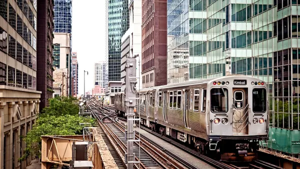
Chicago Eliminates Parking Minimums Near Transit
Changes to a city ordinance make it easier to build ‘by-right’ car-free developments near train stations and pave the way for more affordable housing.

Answers to 12 Questions About California Assembly Bill 1401
Assembly Bill 1401, one of the most closely-watched land use bills in the California State legislature this year, would remove parking requirements in "High Quality Transit Areas" statewide.

Planetizen Federal Action Tracker
A weekly monitor of how Trump’s orders and actions are impacting planners and planning in America.

The state-sanctioned urbicide of Austin
People don’t kill cities. Freeways do.

US to reduce Colorado River water deliveries to Mexico
A new Colorado Treaty amendment reduces Mexico’s Colorado River water allocation by 250,000 acre feet.

Nation's most wind-powered state turns to coal as data centers increase energy demand
For the first time in decades, Iowa has increased its generation of coal power.

NYC cools commuters with city's first rain garden above a bus stop
New York City officials say the plants in the rain garden can absorb 16 gallons of rainwater during heavy storms.

Brightline West’s future may rely on $6 billion federal loan
The company has until Nov. 2 to make a $400 million equity investment into its proposed high-speed rail line.

FREE Course: Walkable City 1: Why Walkability?
After describing his path towards focusing on walkability as the essence of good planning, Jeff Speck marches through his five principal reasons for making more walkable places.
Reinventing Malls: Planning Alchemy—Turning Gray Fields Into Gold
The course focuses on the opportunities and imperatives that shape reinvention of mall sites.

Eagle County Government
Harvard University Graduate School of Design
Nashville Planning Department
The Architects Foundation
University of Cincinnati Online
The Pocatello Development Authority
The Urban Renewal Agency of the City of Pocatello
Journal of the American Planning Association