


In a recent Huffington Post article, F. Kaid Benfield of the Natural Resources Defense Council breaks down some of the barriers for walkability in the United States.
As the United States coming is in dead last for both transit use and walking according to National Geographic's 17-nation Greendex study, it comes as no surprise that Americans prefer driving. Benfield credits this to three major factors in his recent piece: inconvenience and danger, roadway design, and legal bias toward drivers.
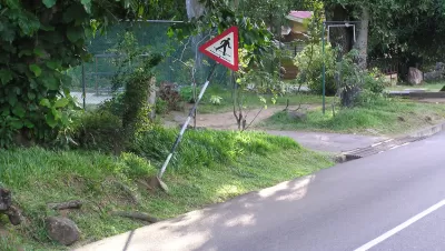
Benfield points out the dangers of walking in certain sprawling metro regions that were designed to accommodate vehicles and not pedestrians. Indeed, "a report released by the nonprofit National Complete Streets Coalition earlier this year analyzed traffic fatality data over a ten-year period; the report found that the country’s top four 'most dangerous' metro regions for pedestrians are all in the state of Florida," with many other locations on the list in the sprawling Sun Belt. Unlike major cities, many of these dangerous regions lack destinations within close proximity and basic pedestrian infrastructure such as sidewalks or frequent crosswalks.
Moreover, many states actually blame pedestrians in vehicle-pedestrian collisions rather than drivers. Benfield delves into Raquel Nelson's case in suburban Atlanta from April 2010 to show the bias of these laws. These combined factors lead to many Americans resisting walking or transit use, and keep them enclosed in their cars.
FULL STORY: Americans Don't Walk Much, and I Don't Blame Them

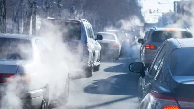
Federal Plan Takes Aim at Transportation Emissions
The U.S. National Blueprint for Transportation Decarbonization is designed to guide federal investment and regulations, focusing on electrification with a nod to transit investment and walkability.
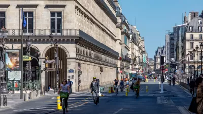
Europe Building a Post-Car Future
While the United States mobilizes to transition to electric cars, cities and countries in Europe are transitioning to fewer cars.
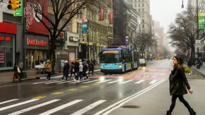
Survey Says New Yorker Want More Protected Bike and Bus Lanes, Less Parking
A new survey reveals broad support for a less car-centric approach to capital investment in the city of New York.

Planetizen Federal Action Tracker
A weekly monitor of how Trump’s orders and actions are impacting planners and planning in America.

Maui's Vacation Rental Debate Turns Ugly
Verbal attacks, misinformation campaigns and fistfights plague a high-stakes debate to convert thousands of vacation rentals into long-term housing.

San Francisco Suspends Traffic Calming Amidst Record Deaths
Citing “a challenging fiscal landscape,” the city will cease the program on the heels of 42 traffic deaths, including 24 pedestrians.

Defunct Pittsburgh Power Plant to Become Residential Tower
A decommissioned steam heat plant will be redeveloped into almost 100 affordable housing units.

Trump Prompts Restructuring of Transportation Research Board in “Unprecedented Overreach”
The TRB has eliminated more than half of its committees including those focused on climate, equity, and cities.

Amtrak Rolls Out New Orleans to Alabama “Mardi Gras” Train
The new service will operate morning and evening departures between Mobile and New Orleans.
Urban Design for Planners 1: Software Tools
This six-course series explores essential urban design concepts using open source software and equips planners with the tools they need to participate fully in the urban design process.
Planning for Universal Design
Learn the tools for implementing Universal Design in planning regulations.
Heyer Gruel & Associates PA
JM Goldson LLC
Custer County Colorado
City of Camden Redevelopment Agency
City of Astoria
Transportation Research & Education Center (TREC) at Portland State University
Jefferson Parish Government
Camden Redevelopment Agency
City of Claremont