


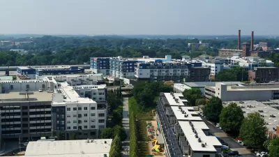
Atlanta's BeltLine is one of the country's most exciting public space projects, and residents have even more reason for excitement after Beltline.org released a fresh batch of renderings for the forthcoming expansion of the Westside Trail.
"A series of Westside Trail concepts and artist renderings lend hope that all will not be quiet on the Beltline's western front soon," reports Josh Green. The "fresh, utopian images," as Green describes them, are of the three-mile Westside Trail project, which has a groundbreaking scheduled for this fall.
The project is made possible by an $18 million TIGER V grant from the U.S. Department of Transportation for the development of the Beltline's southwest corridor. More details on the project visualized by the new renderings: "The trail will snake from Washington Park to Adair Park with 14 points of entry, utilizing the existing West End Trail in the West End neighborhood. Expect a 14-foot-wide concrete multi-use trail similar to the madly popular eastside one. Officials say construction should take about 18 months, meaning the trail could open in the spring of 2016."
FULL STORY: New Westside Trail Renderings Predict Beltline Utopia!

New Study Commissioned for Atlanta BeltLine Transit
The study will assess alignment options for a 13-mile segment of the greenway.
Southside Trail Takes Atlanta's Beltline to the Next Level
Doubters questioned whether Atlanta had the political will to bring the Beltline to the Southside. The city overcame those doubts last week.

Affordable Housing Funding Reaches New Heights for Beltline Neighborhoods
The city of Atlanta has allocated $11.9 million of its $45 million budget for the Beltline for affordable housing.

Maui's Vacation Rental Debate Turns Ugly
Verbal attacks, misinformation campaigns and fistfights plague a high-stakes debate to convert thousands of vacation rentals into long-term housing.

Planetizen Federal Action Tracker
A weekly monitor of how Trump’s orders and actions are impacting planners and planning in America.

San Francisco Suspends Traffic Calming Amidst Record Deaths
Citing “a challenging fiscal landscape,” the city will cease the program on the heels of 42 traffic deaths, including 24 pedestrians.

Bend, Oregon Zoning Reforms Prioritize Small-Scale Housing
The city altered its zoning code to allow multi-family housing and eliminated parking mandates citywide.

Amtrak Cutting Jobs, Funding to High-Speed Rail
The agency plans to cut 10 percent of its workforce and has confirmed it will not fund new high-speed rail projects.

LA Denies Basic Services to Unhoused Residents
The city has repeatedly failed to respond to requests for trash pickup at encampment sites, and eliminated a program that provided mobile showers and toilets.
Urban Design for Planners 1: Software Tools
This six-course series explores essential urban design concepts using open source software and equips planners with the tools they need to participate fully in the urban design process.
Planning for Universal Design
Learn the tools for implementing Universal Design in planning regulations.
planning NEXT
Appalachian Highlands Housing Partners
Mpact (founded as Rail~Volution)
City of Camden Redevelopment Agency
City of Astoria
City of Portland
City of Laramie