


The 596 Acres project to catalogue and improve vacant, publicly owned lots in New York City produced another great tool called the Urban Reviewer, which gathers all of New York's adopted neighborhood master plans in one place.
Sarah Goodyear tells the story of 596 Acres, a group that has worked since 2010 to map all of the publicly owned vacant land in New York City (the group has also expanded its efforts to Philadelphia, Los Angeles, and New Orleans). After noticing that many of the city's empty parcels were "related to the master planning and urban renewal efforts that took hold in the United States in the mid-20th century."
That's when co-founder Paula Z. Segal and 596 Acres, along with design firms Partner & Partners and SmartSign, undertook the Urban Reviewer project, which gathers all 155 adopted neighborhood master plans for New York City in one searchable map.
"Click on an area where a master plan was adopted and you will get scans of the original plan as well as detailed information about individual lots. There's also a way to leave stories and feedback for the researchers, and the site features essays that put the information into historical and political context," writes Goodyear.
FULL STORY: Every Master Plan in New York City History, Collected in a Single Place

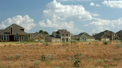
Study: There's a Lot of Vacant Land in Texas Cities
All that empty acreage means that these big, rapidly developing cities don’t really have to sprawl.
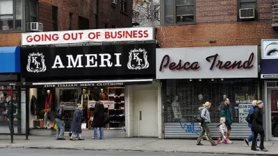
'High-Rent Blight' on the Rise in Manhattan Retail Districts
Why are so many shops closing in New York's richest and best-known neighborhoods?
Vacant Properties Linger Post-Sandy in Queens and Rockaway
Still plagued by home left vacant after Hurricane Sandy, a politician and local activists are pushing for greater action to clean up the blighted properties.

Maui's Vacation Rental Debate Turns Ugly
Verbal attacks, misinformation campaigns and fistfights plague a high-stakes debate to convert thousands of vacation rentals into long-term housing.

Planetizen Federal Action Tracker
A weekly monitor of how Trump’s orders and actions are impacting planners and planning in America.

In Urban Planning, AI Prompting Could be the New Design Thinking
Creativity has long been key to great urban design. What if we see AI as our new creative partner?

King County Supportive Housing Program Offers Hope for Unhoused Residents
The county is taking a ‘Housing First’ approach that prioritizes getting people into housing, then offering wraparound supportive services.

Researchers Use AI to Get Clearer Picture of US Housing
Analysts are using artificial intelligence to supercharge their research by allowing them to comb through data faster. Though these AI tools can be error prone, they save time and housing researchers are optimistic about the future.

Making Shared Micromobility More Inclusive
Cities and shared mobility system operators can do more to include people with disabilities in planning and operations, per a new report.
Urban Design for Planners 1: Software Tools
This six-course series explores essential urban design concepts using open source software and equips planners with the tools they need to participate fully in the urban design process.
Planning for Universal Design
Learn the tools for implementing Universal Design in planning regulations.
planning NEXT
Appalachian Highlands Housing Partners
Mpact (founded as Rail~Volution)
City of Camden Redevelopment Agency
City of Astoria
City of Portland
City of Laramie