


Sarah Goodyear discovers a project to help Brooklynites reclaim land owned by the city, but long since abandoned, and building neighborhood bonds in the process.
When lawyer Paula Z. Segal began investigating a vacant tract of land near her home last year, she set the wheels in motion for a project that would span the entirety of Brooklyn and create the potential for a vast expanse of new public space.
The lot, she discovered, had been taken over by the city's Department of Environmental Protection some years prior to provide access for a public works project, long since completed. But in the course of her research, she discovered that this lot was not alone – there are 596 acres of such government-owned, unoccupied parcels throughout the borough, almost three-quarters the size of Central Park.
And so, she and a handful of volunteers came together to form the aptly-named 596 Acres, a project devoted to identifying these vacant lots and giving the community the tools they need to take them back.
"596 Acres helps people to navigate bureaucracy, governance structures, and neighborhood dynamics," Goodyear writes. "The group has printed a broadsheet with a flowchart that outlines the complicated processes involved without making it all seems hopelessly intimidating."
While the organization strongly advocates the creation of community gardens, their objective is ultimately to undo the blight caused by visibly underutilized open spaces. "We want to see people being able to regain control over what's going on in their neighborhoods," says Segal.
FULL STORY: No vacancy: Unleashing the potential of empty urban land

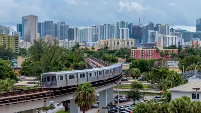
New Tool Puts Miami Development Opportunities on the Map
There's plenty of vacant or underutilized land to be found in Miami-Dade County, if you know where and how to look.
Judge Halts Brooklyn Bike Lane Removal
Lawyers must prove the city was not acting “arbitrarily, capriciously, and illegally” in ordering the hasty removal.
NYC Council Approves Brooklyn Rezoning Plan
The Atlantic Avenue Mixed Use Plan includes infrastructure investments and could bring 4,600 new housing units to parts of Brooklyn.

Planetizen Federal Action Tracker
A weekly monitor of how Trump’s orders and actions are impacting planners and planning in America.

Map: Where Senate Republicans Want to Sell Your Public Lands
For public land advocates, the Senate Republicans’ proposal to sell millions of acres of public land in the West is “the biggest fight of their careers.”

Restaurant Patios Were a Pandemic Win — Why Were They so Hard to Keep?
Social distancing requirements and changes in travel patterns prompted cities to pilot new uses for street and sidewalk space. Then it got complicated.

Albuquerque Route 66 Motels Become Affordable Housing
A $4 million city fund is incentivizing developers to breathe new life into derelict midcentury motels.

DC Area County Eliminates Bus Fares
Montgomery County joins a growing trend of making transit free.

Platform Pilsner: Vancouver Transit Agency Releases... a Beer?
TransLink will receive a portion of every sale of the four-pack.
Urban Design for Planners 1: Software Tools
This six-course series explores essential urban design concepts using open source software and equips planners with the tools they need to participate fully in the urban design process.
Planning for Universal Design
Learn the tools for implementing Universal Design in planning regulations.
Heyer Gruel & Associates PA
JM Goldson LLC
Custer County Colorado
City of Camden Redevelopment Agency
City of Astoria
Transportation Research & Education Center (TREC) at Portland State University
Camden Redevelopment Agency
City of Claremont
Municipality of Princeton (NJ)