


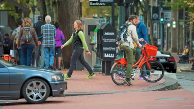
A new report authored by Chris Leinberger and Patrick Lynch, called "Foot Traffic Ahead," ranks walkable urban places (or "WalkUPs") around the country.

A Smart Growth America press release summarizes the "Foot Traffic Ahead" findings along with its institutional support: "Walkable real estate development projects and places are on the rise nationwide, but certain metro regions are progressing faster than others, according to a new report released today by the Center for Real Estate and Urban Analysis at George Washington University School of Business in conjunction with LOCUS: Responsible Real Estate Developers and Investors, a program of Smart Growth America."
The report is an updated version of a 2007 survey by the Brookings Institution’s Metropolitan Policy Program, which compared the economic performance of metropolitan areas’ walkable urban places to their drivable suburban counterparts.
Also from the press release: "While metro areas like Washington, DC, New York City, Boston, the San Francisco Bay Area and Chicago ranked among the top current areas for walkable urbanism, the report found that other cities including Miami, Atlanta and Detroit are well positioned for future growth of walkable places given current efforts in those the communities."
For a sample of how the news of the study was handled around the country, from Los Angeles to Baltimore to Dallas, peruse the "Related Links" below.
FULL STORY: Foot Traffic Ahead: Ranking Walkable Urbanism in America’s Largest Metros


Bikes Are More Popular Than Ever in New York City, City Officials Say
Build safe infrastructure and people on bikes will come, according to New York City officials.
Roadways for People: The Necessity of Collaboration
Breaking down planning silos to ensure transportation options in a car-oriented world.

Atlanta Street Extension Project Will Benefit Transit Access
Plans to extend 15th Street in Midtown Atlanta are designed to improve access to the Arts Center MARTA station.

Planetizen Federal Action Tracker
A weekly monitor of how Trump’s orders and actions are impacting planners and planning in America.

Maui's Vacation Rental Debate Turns Ugly
Verbal attacks, misinformation campaigns and fistfights plague a high-stakes debate to convert thousands of vacation rentals into long-term housing.

San Francisco Suspends Traffic Calming Amidst Record Deaths
Citing “a challenging fiscal landscape,” the city will cease the program on the heels of 42 traffic deaths, including 24 pedestrians.

Amtrak Rolls Out New Orleans to Alabama “Mardi Gras” Train
The new service will operate morning and evening departures between Mobile and New Orleans.

The Subversive Car-Free Guide to Trump's Great American Road Trip
Car-free ways to access Chicagoland’s best tourist attractions.

San Antonio and Austin are Fusing Into one Massive Megaregion
The region spanning the two central Texas cities is growing fast, posing challenges for local infrastructure and water supplies.
Urban Design for Planners 1: Software Tools
This six-course series explores essential urban design concepts using open source software and equips planners with the tools they need to participate fully in the urban design process.
Planning for Universal Design
Learn the tools for implementing Universal Design in planning regulations.
Heyer Gruel & Associates PA
JM Goldson LLC
Custer County Colorado
City of Camden Redevelopment Agency
City of Astoria
Transportation Research & Education Center (TREC) at Portland State University
Jefferson Parish Government
Camden Redevelopment Agency
City of Claremont