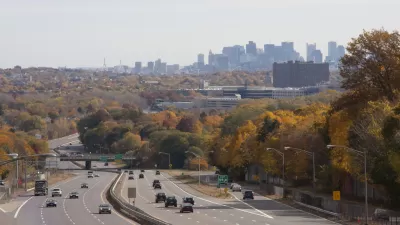
Suburbanization has not led to shorter commutes—except perhaps for residents of the most job-rich, affluent suburbs.

In debates over sprawl, sometimes I hear something like the following conversation:
SMART GROWTH SUPPORTER: Sprawl means ever-lengthening commutes from suburbia, which is bad because no one likes long commutes.
SPRAWL SUPPORTER: Wrong! Sprawl actually means shorter commutes because the jobs move to suburbia where the people are!
If sprawl supporter was right, suburbs would consistently have shorter commutes than cities.* Do they? Sometimes, but not always. The equation of "suburbia" with "long commutes" or "short commutes" treats suburbia as a homogenous mass. But in fact, not all suburbs are created equal. Residents of the "favored quarter" (that is, the portion of the region with the most affluent, job-rich suburbs) have average commuting times comparable to those of urbanites, while poorer, more diverse inner suburbs and remote middle-middle class exurbs have the longest commutes of all.
For example, according to recent Census data, Washington, D.C. has an average commute of 30 minutes—shorter than most of its suburbs, but longer than nearby Arlington and Alexandria (both mostly well-off, both full of federal jobs). Three affluent counties in the region's northwestern "favored quarter" (Loudoun, Montgomery, and Fairfax) clock in at 32-34 minutes, just slightly ahead of the District.
By contrast, more diverse suburban counties have longer commutes. Majority-black Prince George's County, east of Washington, has an average commute of 36 minutes, while two middle-class, racially diverse counties to the south of Washington (Prince William and Charles Counties) have the longest commutes in the region: Prince William County at 39 minutes, Charles County at 43. In 1990, all of these counties had shorter commutes, but the rank-order among counties was roughly the same: the three "favored quarter" northwestern suburbs had shorter commute times than the eastern and southern suburbs, while the central city had lower commute times than any Washington suburb other than Arlington and Alexandria.
In Jacksonville, Fla. the urban county (Duval) has the lowest commute times (23 minutes). But again there is a gap between "favored quarter" suburbs and others. The most affluent suburb (St. Johns County, where many of my faculty colleagues lived) had the second lowest commute time (25 minutes). By contrast, Clay County west of Jacksonville (which is also middle-class but slightly less affluent) has a 32-minute commute time, and the northern suburban counties (Baker and Nassau Counties) had 29-30 minute commute times. The 1990 data show a similar pattern: Duval and St. Johns Counties had shorter commutes than the western and northern suburbs.
In St. Louis, the city of St. Louis and the closest-in suburban county (St. Louis County) both average 23-24 minutes. But this apparent similarity conceals quite a bit of diversity, because St. Louis County includes both the central-western favored quarter and poorer suburbs to the north and south. A look at census tract commuting maps shows the correlation between affluence and commuting times: census tracts with less than a 20-minute average commute run in a band from downtown west to the outer suburb of Town and County, running through a variety of affluent places (though, somewhat to my surprise, job-rich Chesterfield averages commutes in the 20s). By contrast, the poorer, blacker census tracts to the north consistently have commutes over 20 minutes, and some even have 30-minute commutes. Jefferson County to the south averages 30-minute commutes.
So what can we learn from this? It seems to me that job sprawl is a zero-sum game for suburbanites: residents of the "favored quarter" (where the bosses live) are better off than they were if jobs were closer to downtown, but everyone else (including other suburbanites) may be worse off. To use a New York example: if I live in Westchester County (north of New York City) I'd rather work in the city than work in Long Island (east and south of Manhattan).
*For an analysis more focused on urban commuting times, you may wish to read this post.

Maui's Vacation Rental Debate Turns Ugly
Verbal attacks, misinformation campaigns and fistfights plague a high-stakes debate to convert thousands of vacation rentals into long-term housing.

Planetizen Federal Action Tracker
A weekly monitor of how Trump’s orders and actions are impacting planners and planning in America.

San Francisco Suspends Traffic Calming Amidst Record Deaths
Citing “a challenging fiscal landscape,” the city will cease the program on the heels of 42 traffic deaths, including 24 pedestrians.

Defunct Pittsburgh Power Plant to Become Residential Tower
A decommissioned steam heat plant will be redeveloped into almost 100 affordable housing units.

Trump Prompts Restructuring of Transportation Research Board in “Unprecedented Overreach”
The TRB has eliminated more than half of its committees including those focused on climate, equity, and cities.

Amtrak Rolls Out New Orleans to Alabama “Mardi Gras” Train
The new service will operate morning and evening departures between Mobile and New Orleans.
Urban Design for Planners 1: Software Tools
This six-course series explores essential urban design concepts using open source software and equips planners with the tools they need to participate fully in the urban design process.
Planning for Universal Design
Learn the tools for implementing Universal Design in planning regulations.
Heyer Gruel & Associates PA
JM Goldson LLC
Custer County Colorado
City of Camden Redevelopment Agency
City of Astoria
Transportation Research & Education Center (TREC) at Portland State University
Jefferson Parish Government
Camden Redevelopment Agency
City of Claremont


