


The city of Youngstown, Ohio has lost 60 percent of its population since the 1960s. The Youngstown 2010 plan attempted to redevelop a new, smaller city, but how well has it accomplished its goals so far?

Recently faculty members from the University of Michigan’s Ford School Center for Local, State, and Urban Policy hosted a panel called “Lessons from Youngstown: Planning for a Smaller, Greener City,” in the process analyzing the impacts of the Youngstown 2010 Plan.
The Youngstown 2010 Plan, according to a recent article by Maya Kalman, “aimed to involve the community in enhancing the rapidly shrinking city.” Moreover, “[Youngstown 2010] differs from most urban plans, which generally focus on community and population growth.”
“Located among the foothills of the Appalachian Mountains, Youngstown was a center for steel production until the industry began to decline in the 1970s. Urban planners have recently approached the city about looking for ways to redevelop a mid-sized city from a once larger metropolis.”
The faculty panel reported both strengths and weaknesses to the plan’s approach. Included in the plan's strengths: acceptance of the city's decline. The article also describes the Youngstown case study as a model for other shrinking cities, such as Detroit.
FULL STORY: Urban policy experts analyze Youngstown plan


Geographers Seek Patterns and Solutions to Help Declining American Cities
Geographers publish results of a two-year study on declining cities around the country in a new book, "Shrinking Cities: Understanding Urban Decline in the United States."
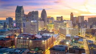
Detroit and Michigan on the Upswing
It's been 66 years since the Motor City last grew its population. Census data released last month revealed an increase of nearly 2,000 people last year, nearly half the state's population growth.

How Shrinking Cities Are 'Right Sizing'
Case studies in dealing with population loss from Ohio, Maryland, and Massachusetts.

Planetizen Federal Action Tracker
A weekly monitor of how Trump’s orders and actions are impacting planners and planning in America.

Restaurant Patios Were a Pandemic Win — Why Were They so Hard to Keep?
Social distancing requirements and changes in travel patterns prompted cities to pilot new uses for street and sidewalk space. Then it got complicated.

Map: Where Senate Republicans Want to Sell Your Public Lands
For public land advocates, the Senate Republicans’ proposal to sell millions of acres of public land in the West is “the biggest fight of their careers.”

Maui's Vacation Rental Debate Turns Ugly
Verbal attacks, misinformation campaigns and fistfights plague a high-stakes debate to convert thousands of vacation rentals into long-term housing.

San Francisco Suspends Traffic Calming Amidst Record Deaths
Citing “a challenging fiscal landscape,” the city will cease the program on the heels of 42 traffic deaths, including 24 pedestrians.

California Homeless Arrests, Citations Spike After Ruling
An investigation reveals that anti-homeless actions increased up to 500% after Grants Pass v. Johnson — even in cities claiming no policy change.
Urban Design for Planners 1: Software Tools
This six-course series explores essential urban design concepts using open source software and equips planners with the tools they need to participate fully in the urban design process.
Planning for Universal Design
Learn the tools for implementing Universal Design in planning regulations.
Heyer Gruel & Associates PA
JM Goldson LLC
Custer County Colorado
City of Camden Redevelopment Agency
City of Astoria
Transportation Research & Education Center (TREC) at Portland State University
Camden Redevelopment Agency
City of Claremont
Municipality of Princeton (NJ)