


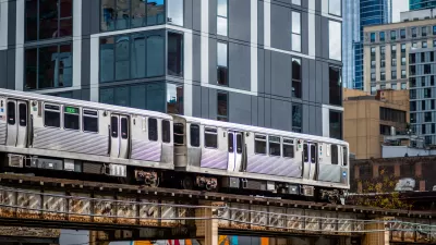
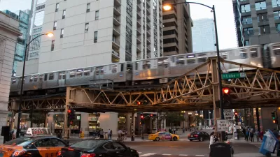
At a recent hearing of the Northeastern Illinois Public Transit Task Force, experts like Peter Skosey made the case for the types of changes necessary to meet Chicago’s goals for increased transit ridership, focusing on transit oriented development.
Illinois Governor Pat Quinn created the Northeastern Illinois Public Transit Task Force to “issue recommendations for creating to create a fiscally and ethically sound regional transit system” after the controversial ouster of former Metra CEO Alex Clifford.
John Greenfield reports from a recent hearing of the task force, focusing specifically on the testimony of the Metropolitan Planning Council’s Peter Skosey.
“Skosey noted that Chicagoland’s GO TO 2040 plan calls for doubling transit ridership by 2040. The region is currently adding 12 million new transit trips annually, but we need to be adding 21 million trips a year to meet that goal, he said. It won’t necessarily require doubling the amount of transit spending to achieve that milestone but rather better strategy and urban planning, he added.”
While car sharing and bike sharing programs, along with a transportation demand management program, much of the heavy lifting in getting to the region’s goals must come from the region’s ample opportunities for TOD. “Region-wide, there’s an opportunity for one-half-million new residents to live within a quarter-mile of transit, as well as room for over 100 million square feet of commercial space,” said Skosey at the meeting.
FULL STORY: To Grow Transit Ridership, Chicagoland Needs to Build Near Transit

Expanding Chicago TOD Zones Could Boost Transit Ridership
Data indicates broadening the definition of transit-oriented zones to include more of the city would put housing within easy reach of transit for more residents and increase ridership.

Chicago Passes Equitable TOD Ordinance
The new legislation will promote more development near transit in the city’s underserved neighborhoods and improve safety for pedestrians and other road users.
Chicago Grants Support Equitable Transit-Oriented Development
The eTOD program centers equity as a consideration for new projects.

Planetizen Federal Action Tracker
A weekly monitor of how Trump’s orders and actions are impacting planners and planning in America.

Maui's Vacation Rental Debate Turns Ugly
Verbal attacks, misinformation campaigns and fistfights plague a high-stakes debate to convert thousands of vacation rentals into long-term housing.

San Francisco Suspends Traffic Calming Amidst Record Deaths
Citing “a challenging fiscal landscape,” the city will cease the program on the heels of 42 traffic deaths, including 24 pedestrians.

Defunct Pittsburgh Power Plant to Become Residential Tower
A decommissioned steam heat plant will be redeveloped into almost 100 affordable housing units.

Trump Prompts Restructuring of Transportation Research Board in “Unprecedented Overreach”
The TRB has eliminated more than half of its committees including those focused on climate, equity, and cities.

Amtrak Rolls Out New Orleans to Alabama “Mardi Gras” Train
The new service will operate morning and evening departures between Mobile and New Orleans.
Urban Design for Planners 1: Software Tools
This six-course series explores essential urban design concepts using open source software and equips planners with the tools they need to participate fully in the urban design process.
Planning for Universal Design
Learn the tools for implementing Universal Design in planning regulations.
Heyer Gruel & Associates PA
JM Goldson LLC
Custer County Colorado
City of Camden Redevelopment Agency
City of Astoria
Transportation Research & Education Center (TREC) at Portland State University
Jefferson Parish Government
Camden Redevelopment Agency
City of Claremont