


Walk Score has published its analysis of the quality of public transit in 50 of the biggest cities in the United States. The rankings may surprise you.
"Upon first glance, the rankings don't seem too surprising. New York City comes in first, as it always should. Boston is the second top-ranked Northeastern city. Washington D.C. is the top Southern city, and San Francisco is the top Western city," observes Ariel Schwartz. But she finds fault with the country's overall rankings.
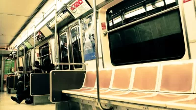
"Somehow, San Francisco comes in second place after New York City. If that's actually the case, the U.S. transportation system is in big trouble. Because while San Francisco is served by many different transit types (subway, light rail, buses), it still can take hours to cross the seven mile by seven mile city using public transportation."
How was San Francisco able to claim a top spot? Walk Score explains its methodology thus: "To calculate a Transit Score, we assign a "usefulness" value to nearby transit routes based on the frequency, type of route (rail, bus, etc.), and distance to the nearest stop on the route. The "usefulness" of all nearby routes is summed and normalized to a score between 0 - 100."
FULL STORY: The Cities With The Best Public Transportation In The U.S.

The Best Cities for Public Transit
Redfin released its updated transit scores for 2019 and, while there’s little change in the ranking, cities like D.C. and New York did see changes in their scores.
America's Top Ten Transit Meccas
Real estate's favorite tool for gauging neighborhood walkability now has a companion for transit, Kaid Benfield reports.

U.S. Transit Agencies Still in Need of a Long-Term Solution to the Looming ‘Fiscal Cliff’
San Francisco and New York exemplify the political challenges in finding long-term finding solutions for public transit in the post-pandemic United States.

Planetizen Federal Action Tracker
A weekly monitor of how Trump’s orders and actions are impacting planners and planning in America.

Maui's Vacation Rental Debate Turns Ugly
Verbal attacks, misinformation campaigns and fistfights plague a high-stakes debate to convert thousands of vacation rentals into long-term housing.

Restaurant Patios Were a Pandemic Win — Why Were They so Hard to Keep?
Social distancing requirements and changes in travel patterns prompted cities to pilot new uses for street and sidewalk space. Then it got complicated.

In California Battle of Housing vs. Environment, Housing Just Won
A new state law significantly limits the power of CEQA, an environmental review law that served as a powerful tool for blocking new development.

Boulder Eliminates Parking Minimums Citywide
Officials estimate the cost of building a single underground parking space at up to $100,000.

Orange County, Florida Adopts Largest US “Sprawl Repair” Code
The ‘Orange Code’ seeks to rectify decades of sprawl-inducing, car-oriented development.
Urban Design for Planners 1: Software Tools
This six-course series explores essential urban design concepts using open source software and equips planners with the tools they need to participate fully in the urban design process.
Planning for Universal Design
Learn the tools for implementing Universal Design in planning regulations.
Heyer Gruel & Associates PA
JM Goldson LLC
Custer County Colorado
City of Camden Redevelopment Agency
City of Astoria
Transportation Research & Education Center (TREC) at Portland State University
Jefferson Parish Government
Camden Redevelopment Agency
City of Claremont