


Real estate's favorite tool for gauging neighborhood walkability now has a companion for transit, Kaid Benfield reports.
As we mentioned earlier this month, the company Walk Score has made a name for itself by creating a system that anyone can use to determine how walkable a neighborhood is. Now, they're expanding that service to measure the usability of transit, too.
According to the index, the nation's top ten cities for transit are (in ascending order):
- Portland, OR (Transit Score: 50)
- Baltimore, MD (57)
- Miami, FL (57)
- Seattle, WA (59)
- Chicago, IL (65)
- Philadelphia, PA (68)
- Washington, D.C. (69)
- Boston, MA (74)
- San Francisco, CA (80)
- New York, NY (81)
Perhaps not surprisingly, the best eight cities for transit top Walk Score's walkability index, too (in a slightly different order).
Benfield explains how the numbers were crunched: "In calculating a Transit Score for a particular location, a 'usefulness' value is assigned to nearby transit routes based on frequency of service, type of route, and distance to the nearest stop on the route. City scores are then calculated by applying the Transit Score algorithm block-by-block throughout the city and weighting the scores by population density. Walk Score's web site contains a detailed description of the methodology used in the transit ratings."
FULL STORY: America's best cities for public transportation

The High-Tech Urban Experience, Now Standardized
The seven largest metros in the nation are teaming up to unify the technologies that are revolutionizing life in the city, Steve Towns reports.
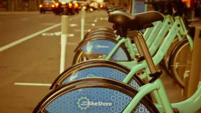
Bike Share Lessons From the Pandemic
Bike share data from six U.S. cities offer insight into how Americans have changed travel patterns during the pandemic.
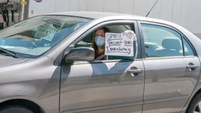
Hotels Could Play a Critical Role in Containing Coronavirus in Crowded Cities
Some cities are leasing entire hotels to provide rooms for people who have tested positive for COVID-19 or been exposed to infected people, to allow for safe and supportive isolation away from family or household members who risk being infected.

Maui's Vacation Rental Debate Turns Ugly
Verbal attacks, misinformation campaigns and fistfights plague a high-stakes debate to convert thousands of vacation rentals into long-term housing.

Planetizen Federal Action Tracker
A weekly monitor of how Trump’s orders and actions are impacting planners and planning in America.

In Urban Planning, AI Prompting Could be the New Design Thinking
Creativity has long been key to great urban design. What if we see AI as our new creative partner?

King County Supportive Housing Program Offers Hope for Unhoused Residents
The county is taking a ‘Housing First’ approach that prioritizes getting people into housing, then offering wraparound supportive services.

Researchers Use AI to Get Clearer Picture of US Housing
Analysts are using artificial intelligence to supercharge their research by allowing them to comb through data faster. Though these AI tools can be error prone, they save time and housing researchers are optimistic about the future.

Making Shared Micromobility More Inclusive
Cities and shared mobility system operators can do more to include people with disabilities in planning and operations, per a new report.
Urban Design for Planners 1: Software Tools
This six-course series explores essential urban design concepts using open source software and equips planners with the tools they need to participate fully in the urban design process.
Planning for Universal Design
Learn the tools for implementing Universal Design in planning regulations.
planning NEXT
Appalachian Highlands Housing Partners
Mpact (founded as Rail~Volution)
City of Camden Redevelopment Agency
City of Astoria
City of Portland
City of Laramie