


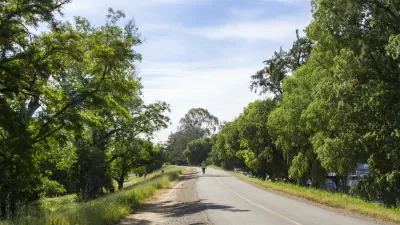
The city of Cleveland recently announced plans to more than double its amount of bike routes in an effort to complete a network of bicycle-friendly infrastructure that connects all of the city’s neighborhoods.
The city of Cleveland is advancing as a bike- and pedestrian-friendly town, even making the list of cities that grew its share of bike commuters most between 1990 and 2012.
With the growing popularity of biking in mind, the city announced an updated bikeway plan that will almost double its current 47.5-mile bicycle infrastructure network by the end of 2017. The plan would add 45 miles of bikeways over the next two years, and 25.6 in the two years following, adding a total of 70 miles in the process.
Alison Grant reports that the “overall goal is to connect every Cleveland neighborhood to a bikeway network.” Grant quotes Jenita McGowan, the city's chief of sustainability in describing the city’s current unconnected patchwork: "It's a lot of bicycling to nowhere.”
Moreover: “Aside from the changes that are part of upcoming Cleveland street projects, the city has identified another 82.5 miles of roads that could be eligible for cycling-related improvements such as restriping and signage. Cleveland has about $1 million earmarked for the work.”
“If it all pans out, the city could have a 200-mile bike network by the end of of 2018.”
FULL STORY: Cleveland plans to add 70 miles of bikeways by the end of 2017

Regional Bikeway System Planned for Sacramento Area
The proposed network would improve connectivity between the area's existing bikeways and increase access to regional job centers.
'Midway' Plan to Transform Cleveland's Old Streetcar Routes to Bike Paths
A coalition of bike advocates and planners have proposed what would be one of the country's most ambitious bike infrastructure projects: transforming the former rights-of-way of Cleveland's street car system into protected bikeways.
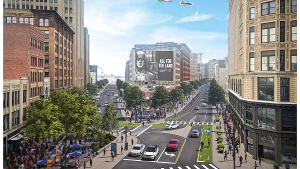
Downtown Cleveland Gets First Ever Protected Bike Lanes
The $200,000 “quick build” lanes are the first of 50 planned miles over five years.

Maui's Vacation Rental Debate Turns Ugly
Verbal attacks, misinformation campaigns and fistfights plague a high-stakes debate to convert thousands of vacation rentals into long-term housing.

Planetizen Federal Action Tracker
A weekly monitor of how Trump’s orders and actions are impacting planners and planning in America.

San Francisco Suspends Traffic Calming Amidst Record Deaths
Citing “a challenging fiscal landscape,” the city will cease the program on the heels of 42 traffic deaths, including 24 pedestrians.

Defunct Pittsburgh Power Plant to Become Residential Tower
A decommissioned steam heat plant will be redeveloped into almost 100 affordable housing units.

Trump Prompts Restructuring of Transportation Research Board in “Unprecedented Overreach”
The TRB has eliminated more than half of its committees including those focused on climate, equity, and cities.

Amtrak Rolls Out New Orleans to Alabama “Mardi Gras” Train
The new service will operate morning and evening departures between Mobile and New Orleans.
Urban Design for Planners 1: Software Tools
This six-course series explores essential urban design concepts using open source software and equips planners with the tools they need to participate fully in the urban design process.
Planning for Universal Design
Learn the tools for implementing Universal Design in planning regulations.
Heyer Gruel & Associates PA
JM Goldson LLC
Custer County Colorado
City of Camden Redevelopment Agency
City of Astoria
Transportation Research & Education Center (TREC) at Portland State University
Jefferson Parish Government
Camden Redevelopment Agency
City of Claremont