


In what might be viewed as a transit version of "fix-it-first", Metro will focus on alleviating congestion within the existing system rather than pursue costly regional expansions. Plans for ten new stations and a new tunnel are being considered.
"More stations and tunnels are needed, Metro officials argue. Not to reach new and different parts of the region, but to take the pressure off its most heavily used and crowded lines," writes
- For Montgomery [MD.], Prince George [MD.]’s and Fairfax [Va.] counties, the rate is 13.7 percent,
- Farther-out suburbs, including parts of West Virginia, the rate of commuting by public transit is 3.9 percent.
FULL STORY: Metro considers building ‘inner loop’ of new stations to ease congestion in system’s core


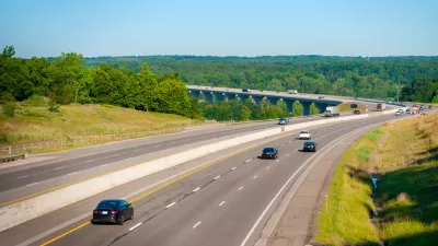
Reconciling Highway Investments With Climate Plans
The Colorado Department of Transportation has plans to expand highways, but it also has a mandate to reduce emissions from the state's transportation systems. Is it possible to do both?
D.C. and Arlington Explore Connection by Gondola
A feasibility study suggests a gondola system across the Potomac would be cheaper than a new Metro station.
Long-Term Transportation Planning Underway in Northeast Ohio
The Northeast Ohio Areawide Coordinating Agency is in the community outreach phase of a long-term transportation planning effort. The plan is expected to be complete by the end of 2016 and ready for board approval early in 2017.

Planetizen Federal Action Tracker
A weekly monitor of how Trump’s orders and actions are impacting planners and planning in America.

Maui's Vacation Rental Debate Turns Ugly
Verbal attacks, misinformation campaigns and fistfights plague a high-stakes debate to convert thousands of vacation rentals into long-term housing.

San Francisco Suspends Traffic Calming Amidst Record Deaths
Citing “a challenging fiscal landscape,” the city will cease the program on the heels of 42 traffic deaths, including 24 pedestrians.

Amtrak Rolls Out New Orleans to Alabama “Mardi Gras” Train
The new service will operate morning and evening departures between Mobile and New Orleans.

The Subversive Car-Free Guide to Trump's Great American Road Trip
Car-free ways to access Chicagoland’s best tourist attractions.

San Antonio and Austin are Fusing Into one Massive Megaregion
The region spanning the two central Texas cities is growing fast, posing challenges for local infrastructure and water supplies.
Urban Design for Planners 1: Software Tools
This six-course series explores essential urban design concepts using open source software and equips planners with the tools they need to participate fully in the urban design process.
Planning for Universal Design
Learn the tools for implementing Universal Design in planning regulations.
Heyer Gruel & Associates PA
JM Goldson LLC
Custer County Colorado
City of Camden Redevelopment Agency
City of Astoria
Transportation Research & Education Center (TREC) at Portland State University
Jefferson Parish Government
Camden Redevelopment Agency
City of Claremont