


The best models of the impacts of climate change have been devoted to understanding global, or even national, changes. But NASA has devoted significant computational resources to projecting future climate conditions at the neighborhood level.
"[N]ew NASA projections that take climate change to a more fine grained understanding," reports Ben Schiller. "Instead of the normal hifalutin picture, these images get down to the block-by-block. They show how Monowi, Nebraska, and Baneberry, Tennessee, are going to experience global warming, not whole continents or even countries or states."
"Climate projections normally deal in scales of 100 to 250 kilometers," explains Schiller. "NASA's new images are of the order of half a mile, or 800 meters. They're the product of past measurements, geographical readings, and a host of greenhouse gas data, all processed over 'hundreds of thousands of supercomputing hours.'"
“'The NEX-DCP30 dataset provides a higher resolution that will be of great reference to the decision-making of natural resource managers, urban planners and the climate change science community,' said Ramakrishna Nemani, senior Earth science researcher at Ames, and a co-author on the study. Details and availability of the new dataset were published in Eos, Transactions American Geophysical Union on Sept.10."
FULL STORY: Forget Continents Or Countries. This Is What Climate Change Will Do To Your Block


Land Use the Subject of Latest IPCC Report
Not urban land use, but in the literal sense: land used to produce food, graze livestock, supply drinking water, grow trees, and sequester carbon. As the climate warms and the population grows, crop yields will decrease and land will be degraded.
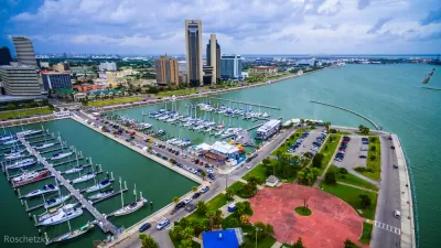
Visualizing Worst-Case Scenario Sea Level Rise on the Texas Coast
Much of the state political leadership in Texas has been slow to accept the existence of climate change, much less the role of the state's economy, land use, and infrastructure planning in exacerbating the crisis. Maybe this will help wake them up?

Rising Seas Could Submerge Much of Jersey Shore by 2100
The doomsday scenario for sea-level rise in New Jersey is worse than that of almost any other state.

Maui's Vacation Rental Debate Turns Ugly
Verbal attacks, misinformation campaigns and fistfights plague a high-stakes debate to convert thousands of vacation rentals into long-term housing.

Planetizen Federal Action Tracker
A weekly monitor of how Trump’s orders and actions are impacting planners and planning in America.

San Francisco Suspends Traffic Calming Amidst Record Deaths
Citing “a challenging fiscal landscape,” the city will cease the program on the heels of 42 traffic deaths, including 24 pedestrians.

Half of Post-Fire Altadena Home Sales Were to Corporations
Large investors are quietly buying up dozens of properties in Altadena, California, where a devastating wildfire destroyed more than 6,000 homes in January.

Opinion: What San Francisco’s Proposed ‘Family Zoning’ Could Really Mean
Mayor Lurie is using ‘family zoning’ to encourage denser development and upzoning — but could the concept actually foster community and more human-scale public spaces?

Jacksonville Launches First Autonomous Transit Shuttle in US
A fleet of 14 fully autonomous vehicles will serve a 3.5-mile downtown Jacksonville route with 12 stops.
Urban Design for Planners 1: Software Tools
This six-course series explores essential urban design concepts using open source software and equips planners with the tools they need to participate fully in the urban design process.
Planning for Universal Design
Learn the tools for implementing Universal Design in planning regulations.
Gallatin County Department of Planning & Community Development
Heyer Gruel & Associates PA
JM Goldson LLC
City of Camden Redevelopment Agency
City of Astoria
Transportation Research & Education Center (TREC) at Portland State University
Jefferson Parish Government
Camden Redevelopment Agency
City of Claremont