


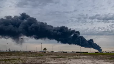
With evidence on the harmful health impacts of vehicle emissions increasing, the EPA will begin monitoring pollution levels adjacent to freeways in Los Angeles and more than 100 of America's biggest cities. Experts say the action is long overdue.
"Though tens of millions of people nationwide live within a few hundred feet of a major road, monitoring stations established to measure common air pollutants typically have been placed away from such thoroughfares and other obvious sources of contamination," writes Tony Barboza. But new EPA rules requiring the monitoring of air pollution within 160 feet of major roadways is catching up to two decades of scientific research on the adverse health impacts of living near freeways.
"The new monitoring is likely to have broad implications," adds Barboza. "If, as expected, the new data show higher pollution levels, environmental organizations and neighborhood activists almost certainly will call for local officials to take more aggressive steps to reduce emissions and curtail residential development near freeways."
"'We will do everything possible to make sure people who live near those roadways get the protections they're entitled to,' said Angela Johnson Meszaros, an attorney for Physicians for Social Responsibility-Los Angeles, one of several advocacy groups that sued the EPA last year to force it to require fine-particle pollution monitoring near Southern California freeways."
"Air quality regulators are now moving in that direction."
FULL STORY: Air board will start monitoring pollution next to SoCal freeways

EPA Grant Will Fund Air Pollution Tracking in Houston
The city wants to monitor air quality and measure cancer-causing emissions near two petrochemical plants, one of which announced plans for expansion last year.
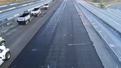
Hot Asphalt May Increase Air Pollution in Urban Areas
Research shows that road asphalt exposed to heat and sunlight may eventually become a significant emissions source.
A 'Good News' Air Pollution Study for a Change
Too often we report on new studies showing how air pollution worsens public health, often causing premature death. For a change, here's a study showing how efforts to improve air quality in Southern California have boosted public health in children.

Maui's Vacation Rental Debate Turns Ugly
Verbal attacks, misinformation campaigns and fistfights plague a high-stakes debate to convert thousands of vacation rentals into long-term housing.

Planetizen Federal Action Tracker
A weekly monitor of how Trump’s orders and actions are impacting planners and planning in America.

San Francisco Suspends Traffic Calming Amidst Record Deaths
Citing “a challenging fiscal landscape,” the city will cease the program on the heels of 42 traffic deaths, including 24 pedestrians.

Defunct Pittsburgh Power Plant to Become Residential Tower
A decommissioned steam heat plant will be redeveloped into almost 100 affordable housing units.

Trump Prompts Restructuring of Transportation Research Board in “Unprecedented Overreach”
The TRB has eliminated more than half of its committees including those focused on climate, equity, and cities.

Amtrak Rolls Out New Orleans to Alabama “Mardi Gras” Train
The new service will operate morning and evening departures between Mobile and New Orleans.
Urban Design for Planners 1: Software Tools
This six-course series explores essential urban design concepts using open source software and equips planners with the tools they need to participate fully in the urban design process.
Planning for Universal Design
Learn the tools for implementing Universal Design in planning regulations.
Heyer Gruel & Associates PA
JM Goldson LLC
Custer County Colorado
City of Camden Redevelopment Agency
City of Astoria
Transportation Research & Education Center (TREC) at Portland State University
Jefferson Parish Government
Camden Redevelopment Agency
City of Claremont