


An announcement last week indicates that Wikipedia will become the newest player in the increasingly competitive effort to connect virtual information with physical places.
No, it doesn't sound like Wikipedia will be taking on Google Maps anytime soon, but last week "software engineer Max Semenik announced that the organization has created a GeoData extension that will include a centralized, structured catalog of geo-coordinates for articles," reports Henry Grabar. "More than 500,000 Wikipedia articles — approximately 5 percent of the site's content — already contain geographical information, but this new initiative will streamline data storage, enabling programmers to mine and map the data quickly and easily through the API."
So what does this mean for us? By more thoroughly geotagging the most popular encyclopedia on the Internet, a treasure trove of information will become available to programmers and entrepreneurs.
"The first appearance of the new GeoData extension is in a mobile add-on called 'Nearby,' which shows users a list of nearby Wikipedia entries. (To activate 'Nearby,' select 'Settings' from the drop-down menu on the Wikipedia Mobile site, then activate 'Beta' mode, save, and then activate 'Here Be Dragons' mode. 'Nearby' will appear in the drop-down menu.)"
"This software is a pretty simple beginning," says Grabar, "but it's easy to see how interesting it could get."
FULL STORY: Wikipedia Nearby Is Basically a List of Interesting Things Near You


Is it Time to Revive the Pattern Language?
Software and other fields have made brilliant progress with the pattern language methodology, while built environment fields lag badly, mired in parochial debates over the massive book that invented the methodology.
Friday Eye Candy: Maps Reveal Differences in How Locals and Tourists See the City
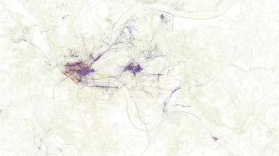
The cities that visitors see will always be different than the city that locals see. A new mapping project reveals the distinctions between the local perspective and the tourist perspective for 136 cities around the globe.

Mapping Interest in All Things Zombie
The three geographers behind the Floating Sheep blog have created a world map of Internet references to zombies.

Planetizen Federal Action Tracker
A weekly monitor of how Trump’s orders and actions are impacting planners and planning in America.

Restaurant Patios Were a Pandemic Win — Why Were They so Hard to Keep?
Social distancing requirements and changes in travel patterns prompted cities to pilot new uses for street and sidewalk space. Then it got complicated.

Map: Where Senate Republicans Want to Sell Your Public Lands
For public land advocates, the Senate Republicans’ proposal to sell millions of acres of public land in the West is “the biggest fight of their careers.”

Maui's Vacation Rental Debate Turns Ugly
Verbal attacks, misinformation campaigns and fistfights plague a high-stakes debate to convert thousands of vacation rentals into long-term housing.

San Francisco Suspends Traffic Calming Amidst Record Deaths
Citing “a challenging fiscal landscape,” the city will cease the program on the heels of 42 traffic deaths, including 24 pedestrians.

California Homeless Arrests, Citations Spike After Ruling
An investigation reveals that anti-homeless actions increased up to 500% after Grants Pass v. Johnson — even in cities claiming no policy change.
Urban Design for Planners 1: Software Tools
This six-course series explores essential urban design concepts using open source software and equips planners with the tools they need to participate fully in the urban design process.
Planning for Universal Design
Learn the tools for implementing Universal Design in planning regulations.
Heyer Gruel & Associates PA
JM Goldson LLC
Custer County Colorado
City of Camden Redevelopment Agency
City of Astoria
Transportation Research & Education Center (TREC) at Portland State University
Camden Redevelopment Agency
City of Claremont
Municipality of Princeton (NJ)